Not only could we see Signal Knob and the rest of the Massanuttens extremely well from I-81 near Stephens City, we could see the shadows outlining each fold and protrustion in the earth and as we got closer, we could see individual trees. That's a clear day, thanks to the cold front that blew through on Saturday. Fortunately, the 20-40mph wind gusts accompanying that front had calmed to 10-20mph gusts on Sunday, leaving us with absolutely perfect hiking weather, starting in the upper-40s and climbing to just over 60.
We headed west on 55/US 48 from Strasburg skirting around the north end of Little North Mountain and crossing Great North Mountain and the Tuscarora Trail before dropping down into the Lost River Valley and Wardensville, WV. At the end of the main drag, just after Lost River Brewing, we turned left onto Trout Run Rd and headed to the well-marked Bucktail Trail parking area about six miles up on the left. This is as easy a trailhead to find as they come.
Coincidentally, Trout Run Rd runs back south and east through Wolf Gap into Shenandoah County, VA where it becomes 675, Wolf Gap Rd, the road we were on last weekend when hiking Big Schloss just over the border in Virginia.
We arrived at the trailhead about 9:45am, it being just slightly less than an hour drive from home, and were perhaps the twelfth car there. Nonetheless, we got a space right next to the gate and we did not see many of those people on the trail. I am guessing that a lot of the cars belonged to overnighters who made a two-day trek of the trail.
It was quite by accident that we got to Halfmoon Mountain on Sunday. Ann was looking at hikes and thought that she had sent me a link to one on the AT that she wanted to do, but ended up cutting and pasting the wrong link, the one to Halfmoon. I liked it so much that I asked if we could do it rather than the out and back hike on the AT. I'd like to get as many hikes in the George Washington National Forest as possible before deer season opens November 21.
Speaking of the GWNF, we really love hiking there as opposed to Shenandoah National Park which sees so many tourists and where the trails can be crowded. Sunday, we saw six hikers all day on our loop which started from the Bucktail parking lot and heading north to the bridge over Halfmoon Run where the Capon Trail starts. From there we headed east up the creek, picked up the Old Mine Trail forest road for a little bit, then climbed the steep German Wilson Trail to the saddle where we turned west and climbed to the summit of Halfmoon Mountain. Back down from there to the yellow-blazed Halfmoon Trail, at this point less than a mile from where we were hiking the Mill Mountain Trail last weekend, to the pink-blazed Bucktail Cutoff Trail and back to the car for a circuit of about 10.6 miles in about five hours.
 |
| We Made the Circuit of Halfmoon Mountain |
As I lamented last weekend, there just isn't much color this year, likely due to the drought in August. From up top, scanning over the mountainsides, you can see sugar maples here and there starting to go red, but the color is not glorious this year. It looks like a year where everything just goes brown and drops, probably on the first rainy day in November. We did happen upon one hickory tree going golden and bathed in sunlight, glowing for all the world to see.
 |
| Lone Hickory Turning Yellow |
The first part of the trail heading north was on fire road and we made very good time (for us) covering 3.5 miles in 90 minutes. Once we hit the bridge over Halfmoon Run, the trail started following the creek east up the hill and footing was a lot more iffy, with a lot of loose rock under the leaves. We crossed the creek several times before climbing up and away from it to meet a wide forest road. At times, it was anyone's guess which side of the creek the actual trail was located on, but there was no doubt that we just needed to follow the creek up the mountain.
 |
| To Make the Loop, Don't Cross This Bridge |
From the wide and open forest road, I nearly missed the turn off to the left for the purple-blazed German Wilson trail. The photographer in me constantly scans the sides of the trail for interesting things to photograph and so things that don't belong stick out to me. I happened to see something rectangular, very much like a sign, up in the bushes on the left. It happened to be the trail sign for the German Wilson trail. I can see that many people would miss this. Be careful.
Upon leaving the fire road, the German Wilson trail became immediately steep and then turned right following a gully between two hills, a dry creek bed. Footing was iffy and my hiking poles came in quite useful in seeking out safe places to step in the deep leaves. This trail was also not well maintained or well marked. The photo below shows what you are dealing with for faint blazes.
 |
| Blazes are Tough to Spot at Times |
 |
| Red Leaf on Mountain Laurel |
The German Wilson trail, though steep, is short and ends in a saddle where it joins the white-blazed trail to the summit of Halfmoon Mountain which is also a short walk from the intersection. Just at the end, it becomes a bit more rocky and more vertical. As you go up, there are more and more views, mainly to the east looking out at Mill Mountain. At the summit, there is the ruined foundation of an old tower.
 |
| Rocks Just Before Summit |
 |
| Looking East at Mill Mountain |
The views at the top are mainly to the south and if you keep pushing past the summit, through the little two-tent camping area in the swale below the tower, and just a bit further west, there is another larger rock outcrop that has fantastic views to the south and west. From the first outcropping just below the abandoned tower, you can see the peaks of Great North Mountain as they stretch away to the south to and beyond Wolf Gap.
 |
| And South at Big Schloss, Wolf Gap, and Tibbet's Knob |
 |
| Annie Checking out Derelict Tower |
The second outcropping gives great views of Trout Run Valley running down to Wolf Gap, framed by Great North Mountain to the east and Long Mountain to the west. Despite the gusty breeze, we took our lunch here at this outcropping and marveled at how beautiful this place is. Even in full sun, we had to pull on an extra layer because of the wind. We had the run of the place while we were up there eating our lunch, wraps of hummus, Canadian bacon, salami, tapenade, and arugula. We last saw a couple who spent the night up top an hour before and we wouldn't see anyone else until we met a threesome of young ladies a mile down the hill, 90 minutes later. That is great solitude.
 |
| Trout Run Valley, Long Mountain to Right |
 |
| Big Schloss Behind Ann |
Coming down off the mountain was a long schlep and in places, my knees were bothering me from the constant downhill. Other than that, it was a fairly uneventful 90-minute walk back to the car. I did notice that the intersection of the yellow- and pink-blazed trails could have been very tricky to find (that is, you could have walked past the head of the pink trail without even noticing it). And once on the pink trail, we did have a couple of moments of "Now, where is that trail?" in the deep leaves.
There was also one turn in the pink blazed trail as it joined an old wagon road for a brief time that could have been really hard to notice had we been going the opposite direction. The temptation would have been to continue straight up the mountain on the wagon trail and totally miss the poorly blazed turn-off. We finally arrived back on the orange-blazed fire road on which we started. We missed seeing the pink-blazed trail take leave of the fire road as we hiked out in the morning. About 20 paces back down the fire road, I turned around to try to understand why I missed the turn-off. At 20 paces, the pink-blazed trail was unrecognizable.
All this is by way of saying that these less popular trails are less well marked and you need to have your wits about you. A map helps too and you should always have a compass. Know how to use them too. It would be nearly impossible to get lost here though, with the mountain to your back in the east, you are in an area bordered by Deep Gutter Run (issuing from Sandstone Spring on the Mill Mountain Trail) to the south, Halfmoon Run to the north, and Trout Run (road and creek) to the west.
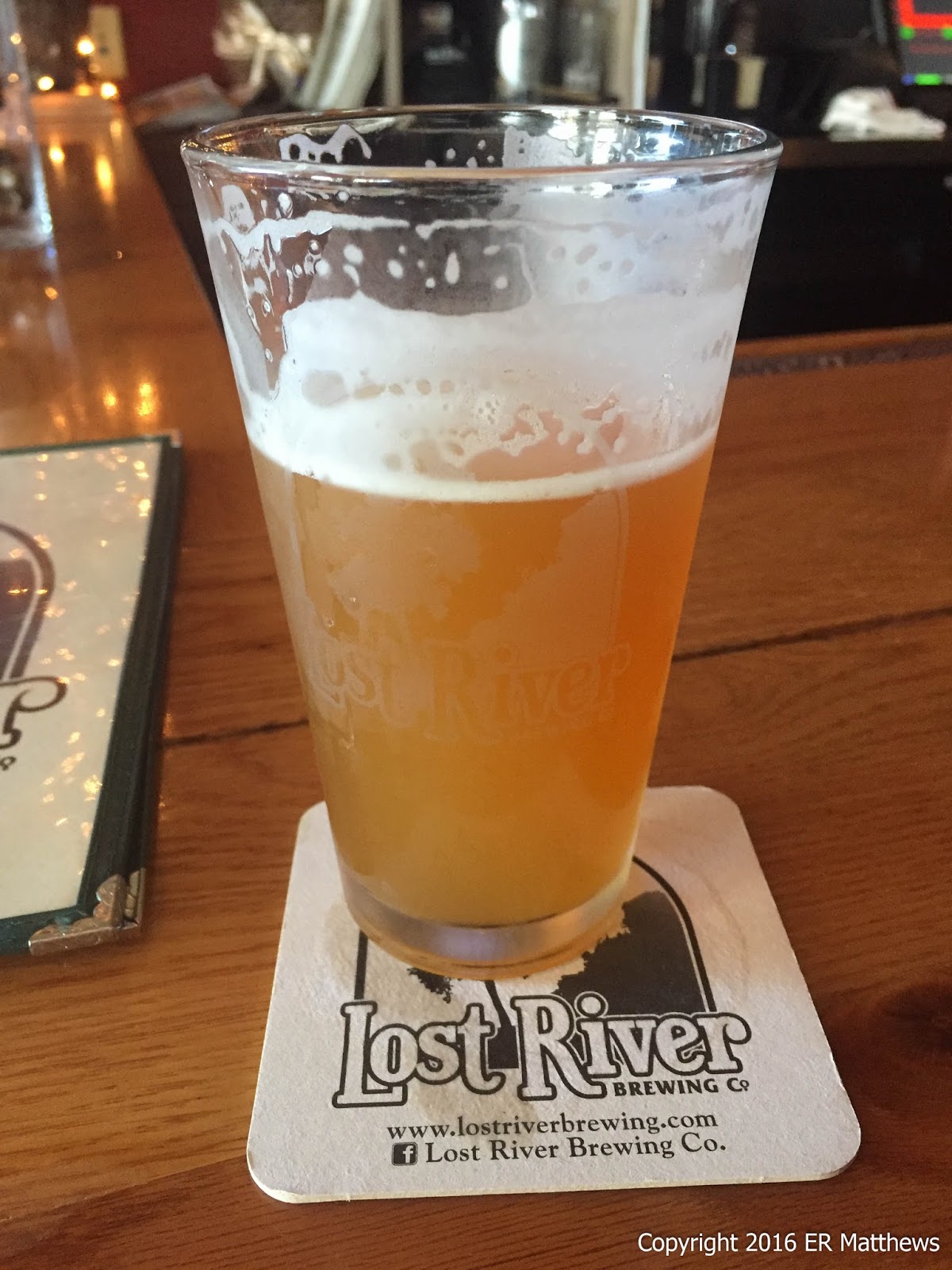
No good hike should be without its just reward and so we stopped in Wardensville at Lost River Brewing. Our
last visit here was in 2012, though to be fair, we did try to stop on the way back from our Labor Day excursion to
Blackwater Falls, but they were closed. We grabbed the two stools at the bar closest to the front door and after a long wait on our unhurried/lackadaisical barkeep, I got a Pale Ale and Ann got a Shocktop. The Pale Ale was decent enough: not the best, not the worst, but fresh and drinkable.
 |
| Lost River, Decent Pale Ale |
Our bartender wasn't too concerned about doing her job. It took some doing to order some food and another beer. The restaurant was somewhat busy, but despite that, the kitchen was really, really slow. Not sure if they are understaffed or staffed with cooks who also run about 35mph in a 60mph zone, just like the bartender. The appetizers Ann ordered were done well. The wings were excellent as were the fries. The fries were desperate for some seasoning, however. After our apps took 35 minutes to come out, I went ahead and put our burger order in so that we wouldn't be sitting there all night.
 |
| Really Good Wings |
 |
| Salt and Vinegar Fries (Absent Salt and Vinegar) |
After waiting for 45 minutes, Ann finally asked the bartender to see if she could find our burgers in the kitchen. This was a new bartender; apparently the shift changed at 4:30. She said, "Didn't she [
the previous bartender] tell you that our burgers take 30-40 minutes to cook?" Being in the business, my bullshit detector hit high alert, but before I could say anything, Ann pretty much cut off her line of bullshit by saying that rare burgers don't take any time to cook and would she go check on them. She came out about five minutes later bearing burgers, well cooked and tasty. The onion rings were great as well. The food was worth the wait.
 |
| A Very Good Burger; Nice Onion Rings Too |
We returned back to Winchester via 259, Carper's Pike, which runs down the VA-WV border for a while, and US 50, just for a change of pace, touring scenic (said tongue in cheek) Yellow Spring and High View, WV. We arrived home just before dark. It was a great day and I recommend both the hike and the brewery.


No comments:
Post a Comment