Tuesday, November 29, 2016

Kelley and Mark

It all started with a random message on Facebook from Kelley last week telling us she missed us. Such is the connectivity or lack thereof in Pocohontas County, WV in the dead zone around NRAO that we are relegated to communicate via FB Messenger. Ann and I have been kicking around the idea of meeting both Kelley and Mark at some halfway point between here and there, about Seneca Rocks, and we mentioned that to her as something we had to do in the spring after they get done with their ski season jobs at Snowshoe.

Long story short, Kelley decided that we needed to do this on Monday and so I cleared my calendar for the 2-hour drive, to hike a little and socialize a lot. But then it turned out that this early in the season, Mark had three days off and they decided to come back to NoVa to attend to some family matters. So they came to our house yesterday late afternoon and stayed for dinner en route to NoVa.

The Three Musketeers
I wanted something really simple for dinner and was thinking about tacos, but I wanted something even less work than that so we could visit and catch up rather than work in the kitchen. I hit on the idea of nachos and then the idea of buying a rotisserie chicken and shredding it on the nachos came to me, so I grabbed a chicken, some grated cheese, and a bag of chips from Costco, and from FoodMaxx some fresh jalapeños, cilantro, a jar of nopalitos, and a can each of black beans and pinto beans.

At home, I drained and rinsed the beans, picked the chicken, pulled the cilantro, and sliced the jalapeños so that at dinner time, all we needed to do was fire up the oven and make some nachos.

Ann Decorating Nachos; Mark Filching Nopalitos
In the photo above, note the so-called "pumpkini," a squash of unknown heritage that Kelley brought along. Most squashes and gourds are somewhat edible and if nothing else, you can generally make soup from them, even if they are super stringy. We got into this one today and found that it has about 1" thick bright orange flesh that is not at all stringy, but it doesn't have any flavor either. It is headed for a squash cream sauce for ricotta gnocchi with chanterelles, rabbit confit, and cavolo nero.

We made two sheet trays of nachos, the first with black beans and the second with pinto beans, between rounds of Cards Against Humanity. A little Prosecco and some red wine might have been drunk. During our match, somebody got the "swooping" card, which none of us could recall ever having encountered before and the reference to which none of us got, so of course, we turned to Urban Dictionary, the arbiter of all things Cards Against Humanity, and found the joke was on us. No spoilers here. Go check for yourself.

Chicken and Pinto Bean Nachos with Nopalitos and Jalapeños
We haven't seen Mark and Kelley since we stayed at their house two Aprils ago and it was just a fantastic short visit to catch up. With my schedule giving me only a single day off a week, opportunities to see them, a 7-hour round trip away, are scarce. We miss them terribly.

Hawksbill

Now that hunting season is open, we're restricting our hikes to lands where hunting is prohibited. We hiked Shenandoah National Park extensively during the summer, to leave it for the relative solitude of George Washington National Forest during leaf season, and now that the hunters are back in GWNF, we're back to SNP where we hiked a 9+ mile loop around and over Hawksbill on Sunday.

Lower Hawksbill Parking Area
At 4050 feet, Hawksbill is the highest point in SNP giving a nearly 270-degree view into Page County to the west and Madison County to the east. The views of nearby Old Rag and Stony Man from the summit of Hawksbill are spectacular. Hawksbill is located right on Skyline Drive between Skyland to the north and Big Meadows to the south, both places we hiked this summer. It's easy access from Skyline Drive and that makes it an extremely popular hike; we waited for the cold weather to deter a lot of hikers.

We started our circuit on the east side of the parkway at the Cedar Run trailhead where we picked up the Skyland-Big Meadows Bridle Trail and walked it parallel to Skyline Drive for about 4.5 miles south to the Rose River Fire Road (that leads down to Dark Hollow Falls) at Fisher's Gap. There we crossed Skyline Drive and picked up the Appalachian Trail on the west side of the mountain and walked it back north to Hawksbill, where we climbed up the west side on the Salamander Trail to the summit. From there, we dropped down the east side to the Lower Hawksbill parking area. We left the Jeep across the road in the parking for Cedar Run.

The Starting Point of Our Hike
The bridle trail is a nice, wide trail that is seldom used by horses. Despite horses being stabled at Skyland and trail rides being offered, I've never encountered a horse on any part of this trail, nor have I ever seen horse droppings. I'm not sure I'd want to tow a horse trailer up these mountains. Aside from a few rocky places and a few sections where we were wading through mid-shin-deep oak leaves, it was smooth walking all four and a half miles.

Lots of Oak Leaves
The morning started cold, well below freezing, and it never really warmed up. We'd get to a sunny spot and I would take my gloves off and then we would duck into a hollow and I would put them back on again, all day. Somewhat paradoxically, the warmest we were all day was up on the summit in the full sun.

The Morning Started Cold

Icicles and Moss
The walk down the bridle trail offers very little in the way of views and not much to photograph, but once you cross Skyline Drive and start walking the AT north in the vicinity of Franklin Cliffs, there are many, many opportunities for awesome views of the Shenandoah Valley to the west.

Franklin Cliffs
We selected one of the big sunny west-facing rock outcroppings on which to eat lunch. It would have been nice to eat up on the summit of Hawksbill, but we were still an hour away and our hunger would not be denied. As we were eating lunch, we heard the half-crow, half-frog croaking of a raven as it soared above us. We watched it glide over and then forgot about it for a little while until we heard the scream of a hawk join the croaking of the raven. Off to our northwest, the raven had spied a Broad-Winged Hawk and was giving it hell. After a couple of minutes of harassment, the hawk finally got free and glided south along the ridgeline, almost directly over our heads. The autofocus on my camera took this opportunity to fail me, being unable to acquire focus at all. Bummer.

Shenandoah Valley Panorama at Our Lunch Spot
Also while we were eating, Ann spied a lone goldenrod still blooming on the cliff face. This is the first flower we've seen in weeks.

A Lone Solidago
The walk north on the AT was fun and in a couple of spots had a couple of steep climbs. Soon enough, we came to the junction of the AT and the Salamander Trail on the west side of Hawksbill and we started climbing. Although we gained about 500 vertical feet over a touch less than three-quarters of a mile, the climb felt very gentle. Just as we started to top out with blue sky 360 degrees around us, we started seeing random balsam firs here and there, a clear sign that we were up at about 4000 feet.

At the top, the summit flattens out and opens up at the site of the stone Byrd's Nest shelter number two, one of a series of shelters caused to be built by Harry Byrd, Senator and Governor of Virginia, one-time Winchester resident before moving to Berryville, and father of my one-time neighbor and Senator Harry Byrd Jr.

Byrd's Nest No. 2
Just beyond the shelter, the trail climbs a handful of feet up to a low-walled stone observation platform, the very highest point on the highest peak in Shenandoah National Park.

Plaque on the Tower at the Summit

Sitting on the Platform Wall

Well Earned Rest

Annie Striking a Pose

Old Rag

Old Rag Through Forest Fire Compass Crenel
From the summit, we proceeded east down the mountain on a much steeper trail than we had climbed on the west. This trail took us, for a few yards at least, through an area of Balsam Firs, which occur in Virginia only at the summits of Hawksbill and next door on the summit of Stony Man. This is a tree we saw much of above 5000 feet in the Smokies, but which really does not grow south of New England and Canada. Pretty cool to see it here.

Balsam Fir, in Virginia??
At one point on the way down, we stopped to investigate the sounds of little feet running through the leaves to see a squirrel darting here and there about us. While I was watching a male Downy Woodpecker do his thing, the squirrel found a nice source of food just above us and proceeded to shower us with gnawings. Note in all these pictures what a spectacular day we had without a cloud to be seen anywhere.

Male Downy Woodpecker

Our Squirrel Friend
Nine and a half miles makes one very thirsty and so we were eager to get on the road and get a beer. Our usual haunt when hiking SNP is PaveMint in Front Royal. Because we have been over in GWNF for leaf season, it had been a while since we visited.

A Sight to Warm a Hiker's Heart
The beers constantly turn over here which is both a blessing and a curse. Find one you really love and you know it will be gone on your next visit. But then, there are always more to be found. I really enjoyed the Lonerider Hoppy Ki Yay from Raleigh. Ann really liked the Lost Coast Tangerine Wheat from Eureka CA.

Lonerider Hoppy Ki Yay: Delicious!
I ended up eating a burger because this is always a safe bet here. They do burgers well. Some other things, not so well. Ann was not particularly happy with her grilled cheese and tomato soup, the sandwich not being cooked long enough to brown or melt the cheese and the soup being too chunky for her liking.

Burgers Are Always Decent

Grilled Cheese and Soup: More Miss than Hit
It proved to be a gorgeous day, chilly but sunny, and a great day to tackle a very popular peak in Shenandoah National Park. This is a must-do hike for anyone visiting SNP.

Friday, November 25, 2016

A Charlie Brown Thanksgiving

I struggled with the title of this post for a minute. I thought about "Chuck and Grace Do The AT" and tossed that in favor of "A Charlie Brown Thanksgiving." In the spirit of Peanuts, Thanksgiving does not have to be big and opulent to be great. It's not about things or food. It's about being with the ones you love and celebrating that you're still here enjoying this show that we call life. Our Thanksgiving yesterday was non-traditional, tiny, decidedly on the cheap, and above all, wonderful.

Charlie

Grace aka Brown
Our Thanksgiving was a day with our dogs Charlie and Grace, who goes by Brown more often than Grace, hence our Charlie Brown Thanksgiving. They don't often appear in the blog because they stay home most of the time. Grace is an eager and enthusiastic hiker and if we just had her, she'd go with us often. Charlie, on the other hand, is our problem child. He's a fearful dog, doesn't do well in new surroundings, and dreads traveling. You can see the difference in the two in the photo below as they get fitted out in their harnesses: Brown is eager to go; Chuck is hating life.

Chuck Hates to Leave the House; Grace is Ready
The reason we're hiking at all on Thanksgiving this year is that the nest is empty. My girls went to see their cousins in Tidewater and Carter went to be with his father in NoVa. After going through a little despondency that we wouldn't have a big Thanksgiving as we have forever, we decided to make lemonade out of these particular lemons and just have a day to ourselves on the trail. What we forgot was that in going to his dad's, our usual dogsitter, Carter, would be unable to take care of the dogs. So, we decided to hike some place close (Charlie hates travel) and give the dogs some exercise. The closest hiking for us is the AT at either Snicker's Gap or Ashby Gap, both about 16 miles from the house, Snicker's being easiest for us to reach.

Approach Trail from Snicker's Gap to AT
We had most recently hiked north from Snicker's Gap to Raven Rocks in April, but it had been years since I have been up to the wildly popular Bear's Den Rocks on the south side of the gap. Since I have been south on the AT here, there have been a lot of improvements and the AT has actually been relocated a touch in this area, for the better. Among the improvements are the signs that you see, attesting to the popularity of this easily reached location in close proximity to a large urban center.

Sign the AT and the Approach Trail
The main attraction here are the Bear's Den Rocks with their view of Route 7, the Shenandoah River, and the Shenandoah Valley with Berryville and Winchester in the background. Given that the rocks are situated an easy walk from a major four-lane highway, herds of people visit the rocks, while only a tiny fraction of them continue south on the AT. As a result, the area around the rocks is trampled nearly to death and is never quiet. Yesterday was no exception. Thanksgiving Day saw lots and lots of visitors to the rocks.


Route 7 and the Valley from Bear's Den Rocks

I Love the Pines on the Rocks

Bear's Den Rocks with Bands of Quartz

Close Up of Quartz Banding
Despite the popularity of Bear's Den Rocks, very few visitors head south from them on the AT into what is affectionately known as the Rollercoaster, a series of hills to be scaled and descended over and over again for miles. The climbs aren't very high as a rule, but they are relentless and they can be pretty steep in sections. This section of the AT doesn't offer any reward (no waterfalls or sweeping vistas) and so many hikers refer to the hills as PUDs, pointless ups and downs.

Whatever you call them, these hills are a really good workout and while each hill is not that strenuous on its own, at the end of the day, you will know you have been on a hike. Because the park corridor is so narrow through this section (we passed two houses backed onto the trail and heard guns and chainsaws blazing all around us), the trail doesn't really have the option of making wide sweeping S curves around the sides of hills; it really does have to go straight up and over for the entire section between Snicker's Gap and Ashby Gap past the Mount Weather complex.

Only Color of the Day

Cool Shelf Fungi

Boulder Wearing a Crown of Ferns
I had it in mind to walk to the Sam Moore shelter and have lunch there, but the climb up from Spout Run on the last hill before the shelter pretty much wiped Charlie out. Ann too. While he seemed to be having a good time doing his thing and drinking in and wading through every creek (as opposed to Grace whose feet shall never be wet), his roll slowed to a crawl going up the hill, so we stopped on a convenient trailside rock and had lunch and water, dogs first, then humans.

In honor of Thanksgiving and as a surprise for Ann, I made sandwiches of turkey breast, cranberry relish, and a traditional dressing so we could have a little mini celebration trailside. Not having any breakfast to speak of, I was famished and demolished my sandwich while both dogs begged for (unforthcoming) handouts. Ann seemed to be pleased at my little surprise.

Turkey, Cranberry, and Dressing Sandwich
After lunch, we headed back north in the direction of the car. The weather was really fantastic for this late in the year. Although it was mainly cloudy all day with a few sprinkles here and there, it was warm, in the lower 50s. There was no question in my mind, when I took the dogs out at 7:30 in the morning, that I would be wearing shorts. I wore shorts and a long-sleeved polypro shirt while Ann, reacting to the horrid weather of the prior weekend, was fully layered. We definitely have different cold tolerance levels.

On our hike back, we passed a couple and three singles coming south, including two SOBOs. It strikes me as very late in the year to be thru-hiking with snow looming in the Smokies, but hey, more power to them. I hope they get to Springer without too much bad weather and without having to bypass the higher peaks for snow.

The Dogs Seemed to Like the Rocks

Tuckered Chuck

Sleepy Brown Dog, Where's the Eagerness Now?
The final climb back towards the rocks and Bear's Den Trail Center is a good climb. At one point, I thought I was going to have to carry Charlie but with enough enforced stops, he made it on his own. After a final look-see at Bear's Den Rocks, we descended to the parking lot and the car. Charlie, who is deathly afraid of the Jeep and traveling, has never looked happier to see the Jeep. He and Grace crashed in the back seat and slept the 20 minutes back to the house.

After getting cleaned up, we decided to cap off our Thanksgiving by seeing Allied (a really well done movie) at Alamo and having some drinks at the bar beforehand. For a movie theatre, they have a pretty decent selection of craft beer including rotating Brooklyn and Dogfish Head taps. In spite of this, I seem pretty much to gravitate to Bell's Two Hearted Ale when I am there.

Cobbler Mountain Cider for Ann

Bells' Two Hearted Ale for Ed
Our Thanksgiving was unusual (a hike with the dogs, beers, and a movie) but it was really great in that Ann and I got to spend all of it together without having to worry about seeing to others. It's the first Thanksgiving I have not cooked in 35 years, 30 for Ann. There's always next year for that. I loved having the day completely off to do whatever we wanted. And I thinks the dogs had a good time too. It was a Happy Thanksgiving.


Wednesday, November 23, 2016

Posole Verde de Pollo

We've been kicking around the idea of throwing something in the crockpot before taking our Sunday hikes so that we would have something warm and delicious waiting for us when we arrived at home. It just hasn't been cold enough yet this year to want something super warm and comforting, but the gale force winds and freezing temperatures on Sunday fixed all that.

I decided to throw together a quick posole verde at work on Saturday, leave it in the fridge overnight, and kick it off before we left on Sunday. So on Friday, I marinated chicken leg quarters in finely minced cilantro stems, garlic, and freshly ground cumin mixed into a slurry with a touch of avocado oil, salt, and pepper.

Also on Friday, I cut up three poblanos and a bunch of green onions; slabbed and charred a medium yellow onion; peeled 18 cloves of garlic; and cleaned a dozen or so small tomatillos. I put the poblanos, yellow onion, garlic, green onion bulbs, and tomatillos on a sheet tray and roasted them until well browned, about 30 minutes. To make the salsa verde, I transferred all this to a pan with the sliced green onion tops, sliced cilantro, and a half gallon of pork stock. After this simmered for half an hour or so, I blended it into a rough sauce and left it in the fridge overnight.

Saturday, I seared the chicken.

Searing the Chicken for Maximum Flavor
Then threw in an onion to start deglazing the pan.

Getting All the Good Bits with an Onion
Then layered the hominy, chicken, and onions in the crockpot.

Layering the Hominy, Chicken, and Onions
Then put the salsa verde over it all and put it in the fridge overnight.

Burying it All in Salsa Verde
And we feasted when we got back from our hike.

Crockpot Posole Verde de Pollo

Tuesday, November 22, 2016

Tibbet Knob/Big Schloss

It wasn't a surprise, the foul winter weather that came roaring in Saturday afternoon and is still raging here and there today, Monday. This winter storm, the one they called Argos, (when did they start naming winter storms?) wreaked havoc across the country all week and even the forecasters couldn't screw this one up: it started howling at 1:15 on Saturday afternoon as predicted, bringing clouds, raging gusts, and splats of sleet.

After weeks of mild weather, winter hit with a vengeance before Thanksgiving, unusually early for this part of the world. Even though we were forewarned of 30-40 mph gusts and ambient temperatures around freezing (to say nothing of wind chill), we reasoned that this storm presented us with a good opportunity to give our gear a true winter shakedown. This will be Ann's first winter hiking and I took a thirty-five year hiatus, with all my gear getting disposed of in my divorce, so I am in the process of re-equipping and remembering old tricks. It proved to be a good tune-up for us both.

Brave Smile Facing the Howling Wind
Our destination this weekend was Wolf Gap right on the Virginia-West Virginia border where we were going to climb both Tibbet Knob to the south and Big Schloss to the north. With a short mileage day and really cold temperatures, we could afford to wait later in the morning for it to warm up a bit, if it was going to warm up, which it really didn't do. In any case, we took our time getting going in the morning, sitting and having coffee before hitting the road just before 9:00 to arrive at Wolf Gap just about 10:00.

Even as we made our way south down I-81 to Woodstock with me holding on to the steering wheel with two hands trying in vain against the raging gusts to stay in my own lane, we could see light snow on Signal Knob and the Massanuttens to the east and on Little North Mountain to the west. What we couldn't see were the snow squalls that we found ourselves in heading up route 675 to Wolf Gap. When we arrived at the Wolf Gap camp ground, ours was the only car in parking lot. When does that ever happen at this most popular of destinations in the George Washington National Forest?

Ours Was the Only Car in the Lot
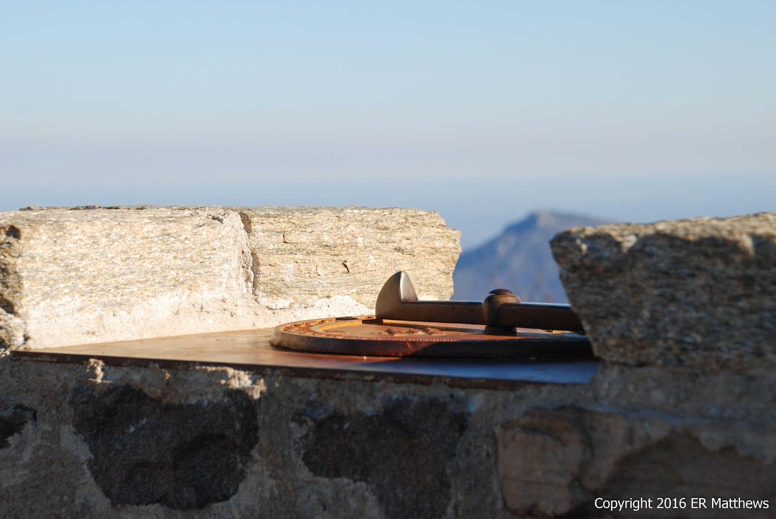
Obligatory Map

We Hiked Both Tibbet Knob and Mill Mountain Trails
Sometimes when hiking, you have to guess about what to wear to account for the weather. Last week, for example, I opted for long pants but by 11am, I was wishing I had worn shorts. In this case, there wasn't much guesswork involved. When I opened the car door, pushing and shoving it into the howling westerly wind, it was obvious what to wear: pretty much everything I brought.

Four layers up top was just about right. With the wind, we never stopped to remove any layers. I regulated my temperature with my hood, beanie, and buff. At one point in the pine woods coming back down off Tibbet Knob, I actually took my gloves off for a quarter mile before we hit the winds screaming through Wolf Gap.

Starting our trek, we hiked off through the snow south in the direction of Tibbet Knob. I love to be the first one to break trail in the snow. It gives me a chance to see all the animal tracks before they get stomped on by humans. I remember one time climbing Sharp Top at Peaks of Otter and seeing both bear and turkey tracks in the snow. Alas, we were not the first on this trail. Somebody with huge boots on had walked the trail in both directions before us. We did not see this person or anyone else until we met a threesome on the way back down from the peak.

Walking in the Snow

Tibbet Knob in the Distance

Looking Northeast from Tibbet Knob Trail
The Tibbet Knob Trail climbs to and follows a ridgeline with great views out east all the way to Shenandoah National Park. Up on the ridge line, we were higher than the clouds in the valley to our east below and it was quite the sight to watch it snow below us. You can see the snow on Wolf Gap Road in the picture below. After the ridgeline, the trail ducks down and then bends right (west) and starts to climb up Tibbet Knob.

Snowing Below Us

As the trail heads westerly over the north flank of Tibbet Knob, it suddenly makes 180-degree switchback to the east before starting a much steeper climb to the south and the summit. We missed the switchback in the snow and continued on a game trail for about 75 yards before realizing that the mountain laurels were starting to choke the trail. We were not the only ones to have made this mistake: from the bootprints in the snow it was clear that the guy who went before us made the same mistake. I took a couple of minutes to drag some brush up to block the wrong turn. The switchback is probably obvious without the snow, but maybe this will keep other parties on the correct trail.

Toward the top of the climb, there are two short rock scrambles that make for an interesting day. This trail is not super kid friendly, but it is certainly not technical either.

Annie Working up Through the Rocks

The Second Rock Scramble
Once you emerge over the top of the second rock scramble, the trail becomes much less steep and you find yourself at the summit very quickly. The views here are to the north and west, about 180 degrees, and it is clear at the top where the views are: a big west-facing rock outcropping. In addition to the exquisite views, there was nothing to stop the gale force winds sweeping in from the plains and Canada. The wind was brutal and I wasn't sure if my photos would turn out because I kept rocking as I snapped frame after frame.

Panorama From Summit of Tibbet Knob
The views were stunning. We could see the entirety of Trout Run Valley from Wolf Gap all the way to Halfmoon Mountain in the north, framed to the west by Long Mountain with its long escarpment of stone and to the east by Great North Mountain (Mill Mountain).

The Entirety of Trout Run Valley

Back to the Wind; Long Mountain Behind
Ann's yellow bandana in the frame below tells the story of the day: it is horizontal in the brutal wind. I am propped against a rock ledge trying to get this picture. I first tried a stunted pine tree for a brace, but it was rocking viciously in the wind. The noise from the wind screaming through the trees was almost deafening at times.

Striking a Pose; Big Schloss Behind
At the top of Tibbet Knob is an awesome camp site. Although it is dry and you have to carry water up to it, it is surrounded by a mountain laurel thicket that keeps it relatively wind free. It is big enough for several tents.

Camp Site at Top of Tibbet Knob

It Was Cold: Two Hoods and a Balaclava Cold
We didn't spend as much time as we would have liked up top because it was so windy and cold. After a few minutes and the obligatory photos, we had about as much of the wind as we wanted and started the trek back to Wolf Gap. In the photo below, we are descending Tibbet Knob with a great view of Big Schloss just ahead through the trees, about three miles distant.

Descending; Big Schloss Ahead
On the way down, once we got in the lee of the hill and the sun came out a bit, it got warm enough for me to take off my gloves and my beanie. But as we progressed north into the saddle that is Wolf Gap, there was nothing to stop the screaming wind or to block the snow flurries. We decided to eat lunch back at the campground. We saw lots of picnic tables that we could have eaten at, but because it had clouded up, the wind had started howling again, and our faces were getting stung with gale-driven snowflakes, we both gravitated to the Jeep for some well-earned shelter.

Our min-feast of wraps of sliced ham, arugula, and hummus flavored with piquillo peppers and Spanish chorizo hit the spot. We didn't dare stay in the car too long and overheat, though I will say that the temptation was there. In the campground, nowhere on any of the sign boards are directions to the Mill Mountain/Big Schloss trail head, but I reasoned it would leave out of the back (the northern end) of the campground and sure enough, it was trivial to find.

Heading North from Wolf Gap
It appears that this trailhead has been the site of one or more Eagle Scout projects: in addition to the signboard, there is a long, nicely built bench, and the initial part of the trail is wide and clearly manicured. The initial climb out of the campground to the ridgeline was steep. It was much worse for me coming back down: my right knee was screaming in agony for about a quarter mile. Once up on the ridgeline, the walking is easy and very similar to all the ridgeline walking the length of Mill Mountain. We have never approached Big Schloss from the south, but the trail is extremely reminiscent of the trail approaching from the north.

There are great views all along the ridge now that the leaves have fallen, views to the east of Little Sluice, Little North Mountain, and stretching way out into the distance, the Massanuttens and the Blue Ridge.

Annie Shooting a Panorama

The Panorama
It was chilly up here on the exposed ridge line, but nothing like it would be up top on Big Schloss. We took advantage of a bit of westerly sun to take a quick selfie. Even in the sun, my four layers are just enough to keep me warm: a polypro t-shirt, a polypro long-sleeved shirt, my Patagonia R1 hoodie, and a cheap and lightweight fleece outer layer to keep out the wind. My Merino wool buff and beanie were instrumental in keeping my head warm.

Ann and I compared notes along the trail about our clothing because part of our reason for being out in crap weather was to shake down our equipment and make any necessary changes for winter. We both found our butts and the fronts of our thighs to be cold through our convertible hiking pants. Ann was uncomfortable enough to want an underlayer under her pants, but I was not. It would need to be a bit colder before I haul out the silk longjohns.

I typically like to use lightweight Merino wool glove liners for hiking, but they kind of sucked on this hike for two reasons: they don't block the wind and they are pretty much useless on the more technical rock sections. I love them because they are super light, easily packable, and I don't like my hands to be too warm. But on today's hike, fail. I picked up a couple pairs of cheap Spandex running gloves for windy weather. We'll see how those do.

And my Merrell Moab low hiking shoes are not what the doctored ordered. I have been looking for replacement boots for a while now and have just about honed in on a pair, which are now hopefully on order. The ventilated low shows are good trail runners for quick summer green tunnel hiking on smooth dirt trails, but I was really worried about keeping them dry in the snow. In addition, the soles are too flexible and I get rock fatigue after about 10 miles on our typical rocky trail. Coupled with no protection on my ankles (this is an issue of rock scrapes, not support) and the fact that lows become dumping grounds for all kinds of trail trash necessitating stops to clean them out, I'm switching back to a boot.

Damn, It was Cold!

Approaching Big Schloss from South

Totally Random Trailside Cairn
The walk up to Big Schloss was uneventful and the solitude was great. It was great fun to have the peak all to ourselves. The wind up top was as wicked as it had been all day. The bridge was rocking as we walked across it and as I climbed up to the top, the wind rammed me into the rockface a couple of times. I kept the exposures on the camera very brief to minimize blur from shaking so much.

The Bridge to the Schloss, Rocking in the Wind

Annie Surveys the Valley

Photographing Her Boots
Ann has this thing for bootshots. Compare this one to the bootshot in October.

Boots on Old Schloss
Back in October, I noticed certain fossilized track-like things in certain of the sandstone rocks on the summit. I decided to photograph them this time. They're pretty neat looking, whatever they are.

Fossilized Something or Other

Looking North at Halfmoon Mountain
Below is a shot that I also made back in October of the summit. The tree to the right was scarlet back then, the smaller tree to the left was yellow. What a difference a month makes!

The Schloss from the Bridge
Our time up on the summit was really limited. We may have spent less time there on Sunday than back in October when it was overrun with people. The wind was too brutal for us to be out in it directly on the rockface for very long. I enjoyed being up there a lot but I was ready to leave. I could hear the beer calling me.

The trip back was uneventful and we even ran into two couples and a mother with two teenagers coming up the trail as we were coming down. By 3:00, it was getting late in the day and the sun was obscured by clouds; it was getting colder still. If I were headed up to the Schloss with only two hours of daylight left (why would I do that in the winter?), I would have plenty of clothes with me and a headlamp for sure. It never ceases to amaze me how unprepared some people are, though from my time in Blue Ridge Mountain Rescue in college, I guess I shouldn't be surprised.

Back at the Jeep at Wolf Gap, we headed west down off the mountain through the Trout Run Valley to Wardensville (a gorgeous drive along the creek) where I finally got a phone signal and could check the weather. At 3:30 in the afternoon as we sat in the warmth of the bar at Lost Mountain Brewing, we could see the snow squalls outside and it seemed like the weather was beginning to deteriorate. I would not want to be the woman in sneakers with just a raincoat and no hat going up to the Schloss with two boys.

Back to the matters at hand. They were out of pale ale, so I had to settle for black ale instead. And instead of the usual hikers post-gaming it at the bar, Sunday it was just drunk hunters taking Sunday off from their tree stands. We met a couple of real characters there before we took our leave to climb back over Great North Mountain to Winchester.

Cold, Windy, and Getting Worse
Lessons learned include keeping granola bars close to your body. I re-remembered that wrangling a frozen granola bar is no fun. Also, our water bladders are going to be a problem; the tube wanted to freeze on me even in relatively mild temperatures. Time to go back to Nalgene's for the winter. Knit gloves are great most of the time, but suck in a gale. Merino wool is the bomb! Soft, light, and truly warm. Trail runners are great for three seasons, but not winter.

Old Chef, New Trick

The last time I ate at Taco Bell would have been when my daughters were tiny young things. My eldest, Lillie, loved their bean burritos and ...