Now that hunting season is open, we're restricting our hikes to lands where hunting is prohibited. We hiked Shenandoah National Park extensively during the summer, to leave it for the relative solitude of George Washington National Forest during leaf season, and now that the hunters are back in GWNF, we're back to SNP where we hiked a 9+ mile loop around and over Hawksbill on Sunday.
 |
| Lower Hawksbill Parking Area |
At 4050 feet, Hawksbill is the highest point in SNP giving a nearly 270-degree view into Page County to the west and Madison County to the east. The views of nearby Old Rag and Stony Man from the summit of Hawksbill are spectacular. Hawksbill is located right on Skyline Drive between Skyland to the north and Big Meadows to the south, both places we hiked this summer. It's easy access from Skyline Drive and that makes it an extremely popular hike; we waited for the cold weather to deter a lot of hikers.
We started our circuit on the east side of the parkway at the Cedar Run trailhead where we picked up the Skyland-Big Meadows Bridle Trail and walked it parallel to Skyline Drive for about 4.5 miles south to the Rose River Fire Road (that leads down to Dark Hollow Falls) at Fisher's Gap. There we crossed Skyline Drive and picked up the Appalachian Trail on the west side of the mountain and walked it back north to Hawksbill, where we climbed up the west side on the Salamander Trail to the summit. From there, we dropped down the east side to the Lower Hawksbill parking area. We left the Jeep across the road in the parking for Cedar Run.
 |
| The Starting Point of Our Hike |
The bridle trail is a nice, wide trail that is seldom used by horses. Despite horses being stabled at Skyland and trail rides being offered, I've never encountered a horse on any part of this trail, nor have I ever seen horse droppings. I'm not sure I'd want to tow a horse trailer up these mountains. Aside from a few rocky places and a few sections where we were wading through mid-shin-deep oak leaves, it was smooth walking all four and a half miles.
 |
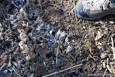
| Lots of Oak Leaves |
The morning started cold, well below freezing, and it never really warmed up. We'd get to a sunny spot and I would take my gloves off and then we would duck into a hollow and I would put them back on again, all day. Somewhat paradoxically, the warmest we were all day was up on the summit in the full sun.
 |
| The Morning Started Cold |
 |
| Icicles and Moss |
The walk down the bridle trail offers very little in the way of views and not much to photograph, but once you cross Skyline Drive and start walking the AT north in the vicinity of Franklin Cliffs, there are many, many opportunities for awesome views of the Shenandoah Valley to the west.
 |
| Franklin Cliffs |
We selected one of the big sunny west-facing rock outcroppings on which to eat lunch. It would have been nice to eat up on the summit of Hawksbill, but we were still an hour away and our hunger would not be denied. As we were eating lunch, we heard the half-crow, half-frog croaking of a raven as it soared above us. We watched it glide over and then forgot about it for a little while until we heard the scream of a hawk join the croaking of the raven. Off to our northwest, the raven had spied a Broad-Winged Hawk and was giving it hell. After a couple of minutes of harassment, the hawk finally got free and glided south along the ridgeline, almost directly over our heads. The autofocus on my camera took this opportunity to fail me, being unable to acquire focus at all. Bummer.
 |
| Shenandoah Valley Panorama at Our Lunch Spot |
Also while we were eating, Ann spied a lone goldenrod still blooming on the cliff face. This is the first flower we've seen in weeks.
 |
| A Lone Solidago |
The walk north on the AT was fun and in a couple of spots had a couple of steep climbs. Soon enough, we came to the junction of the AT and the Salamander Trail on the west side of Hawksbill and we started climbing. Although we gained about 500 vertical feet over a touch less than three-quarters of a mile, the climb felt very gentle. Just as we started to top out with blue sky 360 degrees around us, we started seeing random balsam firs here and there, a clear sign that we were up at about 4000 feet.
At the top, the summit flattens out and opens up at the site of the stone Byrd's Nest shelter number two, one of a series of shelters caused to be built by Harry Byrd, Senator and Governor of Virginia, one-time Winchester resident before moving to Berryville, and father of my one-time neighbor and Senator Harry Byrd Jr.
 |
| Byrd's Nest No. 2 |
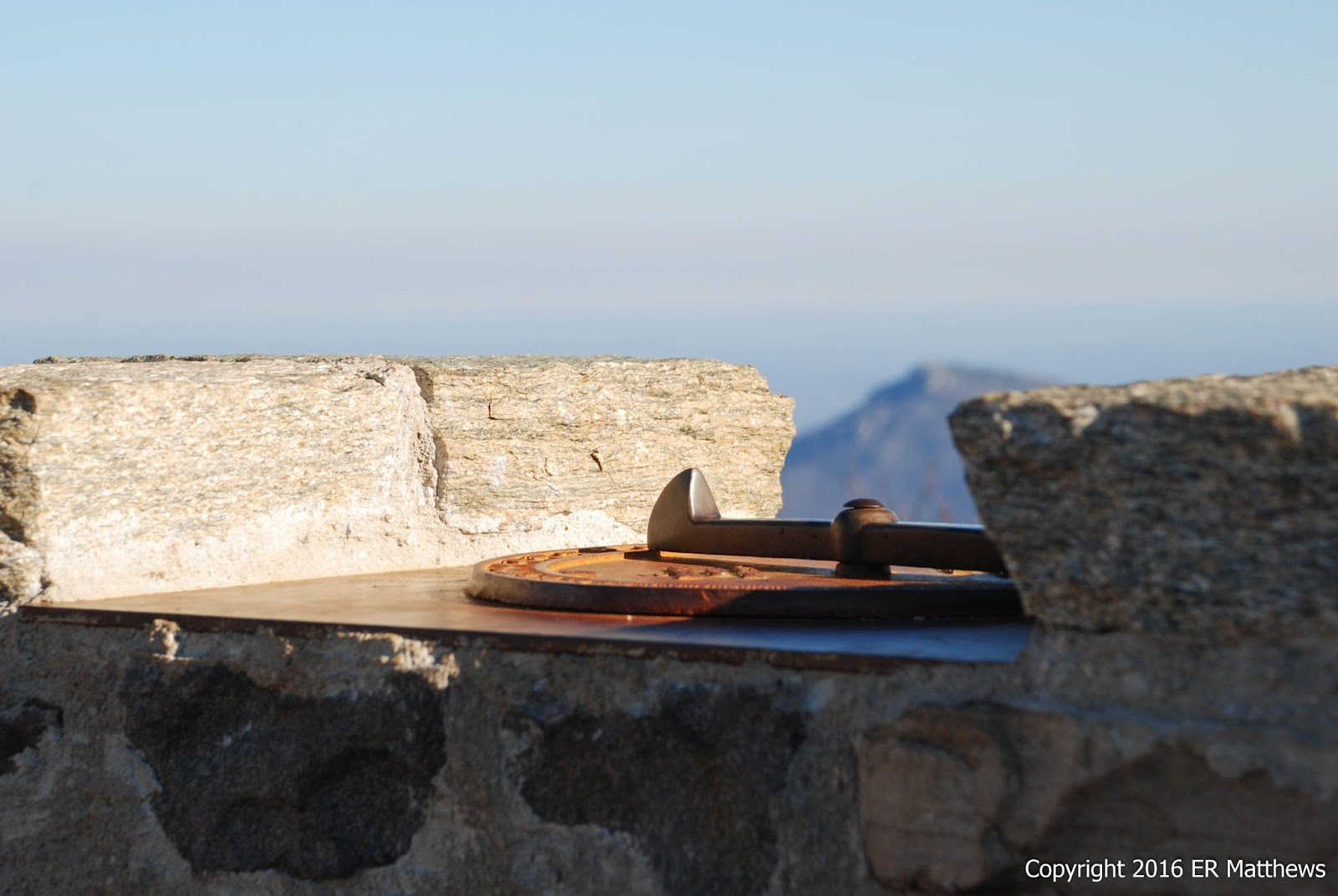
Just beyond the shelter, the trail climbs a handful of feet up to a low-walled stone observation platform, the very highest point on the highest peak in Shenandoah National Park.
 |
| Plaque on the Tower at the Summit |
 |
| Sitting on the Platform Wall |
 |
| Well Earned Rest |
 |
| Annie Striking a Pose |
 |
| Old Rag |
 |
| Old Rag Through Forest Fire Compass Crenel |
From the summit, we proceeded east down the mountain on a much steeper trail than we had climbed on the west. This trail took us, for a few yards at least, through an area of Balsam Firs, which occur in Virginia only at the summits of Hawksbill and next door on the summit of Stony Man. This is a tree we saw much of above 5000 feet in the Smokies, but which really does not grow south of New England and Canada. Pretty cool to see it here.
 |
| Balsam Fir, in Virginia?? |
At one point on the way down, we stopped to investigate the sounds of little feet running through the leaves to see a squirrel darting here and there about us. While I was watching a male Downy Woodpecker do his thing, the squirrel found a nice source of food just above us and proceeded to shower us with gnawings. Note in all these pictures what a spectacular day we had without a cloud to be seen anywhere.
 |
| Male Downy Woodpecker |
 |
| Our Squirrel Friend |
Nine and a half miles makes one very thirsty and so we were eager to get on the road and get a beer. Our usual haunt when hiking SNP is PaveMint in Front Royal. Because we have been over in GWNF for leaf season, it had been a while since we visited.
 |
| A Sight to Warm a Hiker's Heart |
The beers constantly turn over here which is both a blessing and a curse. Find one you really love and you know it will be gone on your next visit. But then, there are always more to be found. I really enjoyed the Lonerider Hoppy Ki Yay from Raleigh. Ann really liked the Lost Coast Tangerine Wheat from Eureka CA.
 |
| Lonerider Hoppy Ki Yay: Delicious! |
I ended up eating a burger because this is always a safe bet here. They do burgers well. Some other things, not so well. Ann was not particularly happy with her grilled cheese and tomato soup, the sandwich not being cooked long enough to brown or melt the cheese and the soup being too chunky for her liking.
 |
| Burgers Are Always Decent |
 |
| Grilled Cheese and Soup: More Miss than Hit |
It proved to be a gorgeous day, chilly but sunny, and a great day to tackle a very popular peak in Shenandoah National Park. This is a must-do hike for anyone visiting SNP.


No comments:
Post a Comment