Leaving Matanuska Brewing in Palmer, we made east to cross the Knik River so that we could take East Knik River Road all the way to its bitter end, the location of the Knik River Lodge and the helicopter base for Alaska Helicopter Tours. There is nothing east of the Lodge but wilderness.
Our path would take us across the Matanuska River (Palmer sits on its west side) and across the point between the two rivers to the bridge over the Knik. On crossing the Matanuska River just outside Palmer, we stopped to have a look at the violently swirling and frothing mass of gray muddy water. All the glacially fed rivers are full of glacial silt. While some are bright blue (such as Portage Creek), most are a sludgy gray. Only the snowmelt rivers are clear.
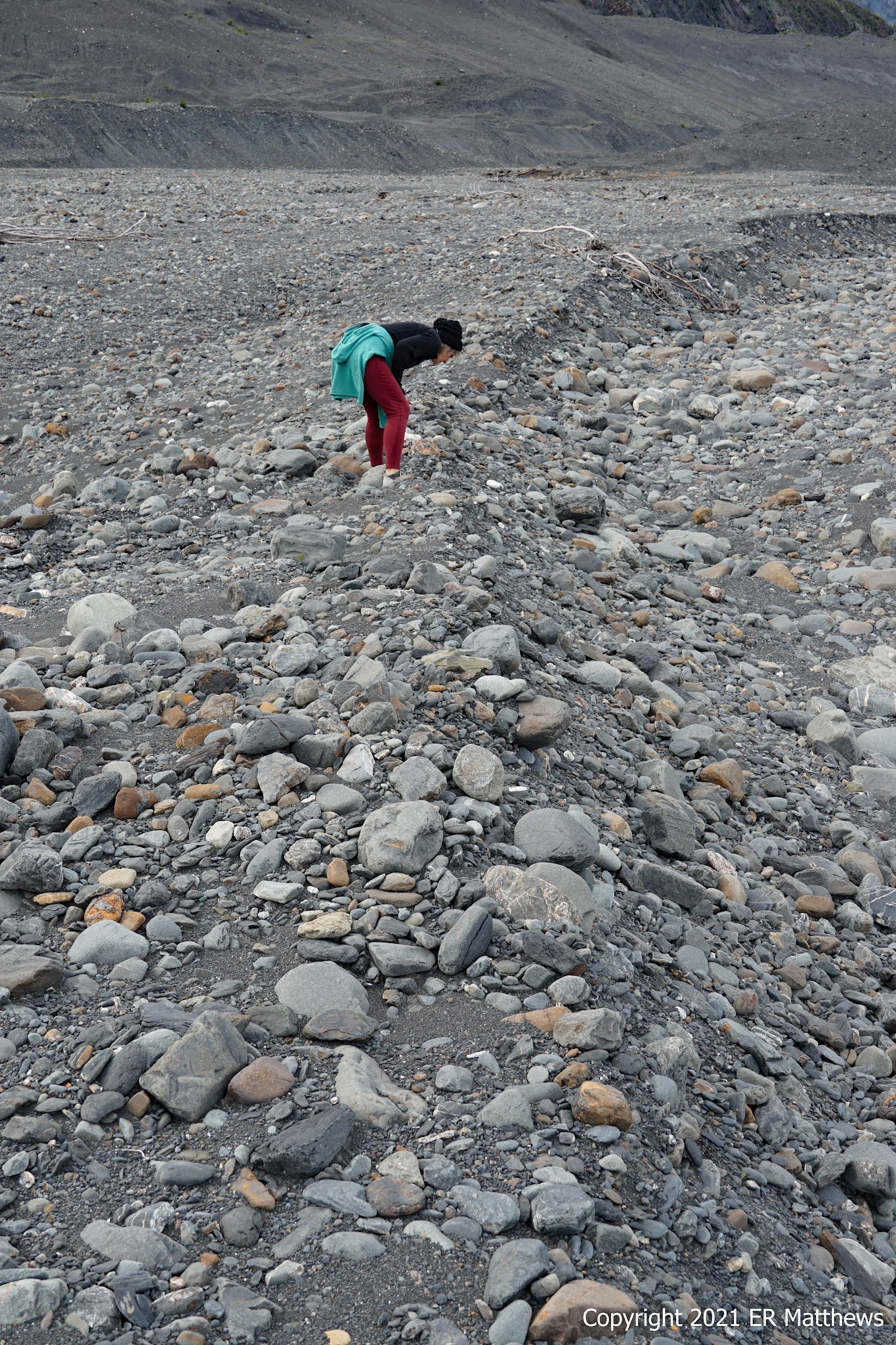
The majority of rivers that we encountered in South Central Alaska are wide, braided (many channels), and very swiftly flowing, with massive pebbled margins that clearly flood in season. The current in these rivers is awesome in the true sense of the word.
 |
| Checking out the Matanuska River |
 |
| Beautiful Clover, Bright Spot on a Gray Day |
Crossing the Knik, we turned left for the about 15-mile drive to the end of the pavement. About halfway to the Knik River Lodge, a large moose was grazing on the side of the road. I sure didn't want to run into it. We pulled into the parking lot for the rustic lodge minutes later.
After waiving away pretty much all of our rights by signing off on the customary CYA paperwork, we wandered out back and sat on a bench overlooking the multiple helipads. Helicopters were coming and going. They appeared to have two kinds of choppers: tiny 4-seaters and larger 6-seaters. Watching one of the pilots in one of the small choppers with no guests tear out of the LZ, it sure looked like a lot of fun to fly. The pilot confirmed later that the small birds are like fine-tuned race cars especially without any load when the weight to power ratio is at its best.
Our tour ran a little behind schedule, probably closer to 5 in leaving and we returned close to 7 rather than 6:30. Times in Alaska seem to be pretty flexible in that the weather often plays into the schedule and transportation will often slow down so that guests can see wildlife. The wait for our helicopter departure gave me time to poke around and snap a few photos.
Ann and I boarded one of the larger choppers with a couple of ladies from the San Jose area, whom we would re-encounter the following day about 100 miles south at the Alaska Wildlife Conservation Center in Portage. How random is that? The women moved about during the legs of our trip so that each could get some time in the front seat. As big as I am, I had to stay in the back to balance the weight. It is what it is.
 |
| Chopper Landing, Knik River in Distance |
 |
| Ann Really Likes Pink Foxtail Barley, Hordeum jubatum |
 |
| Gorgeous Red Elderberries, Sambucus racemosa |
 |
| Moose Sheds Collected by a Pilot |
During our two-hour flight, our pilot Josh took us upriver to see three glaciers: Knik, Colony, and Lake George, with the actual lake Lake George sitting between the three. On the way upriver, Ann saw three black bears by virtue of sitting on the right side of the chopper. On the left side, I only saw one of the three. Not to worry: I have seen hundreds of black bears in my life. It's brown bears that I am most looking forward to seeing on this trip and next week, we have booked a bush plane to take us to Katmai National Park in hopes of seeing them.
Going up the river, our first views were of the massive Knik Glacier, five miles across at the foot/snout and about 27 miles long. From the air, the glaciers look large but not all that massive, until we realized that the chopper seemed like it was creeping along when in fact our groundspeed was 150mph!
 |
| Knik Glacier Snout About Five Miles Wide |
 |
Knik Glacier Medial Moraine
|
Passing the snout of Knik Glacier, we flew some distance up Colony Glacier before doing a 180 and looking for a flat spot to land on the bluffs above the glacier, the first of three landing spots.
 |
| Colony Glacier Medial Moraines |
 |
Colony Glacier Looking at Lake George,
Knik Glacier in Distance |
The first potential landing site was occupied by a bear, the second one proved to be on too much of an angle, and the Goldilocks site proved to be a knob overlooking the glacier below. When the rotors stopped turning, we unbuckled and hopped down out of the chopper onto a gravelly knob covered in very low vegetation, generally less than a foot high. The vegetation seemed to be mainly reindeer lichen, alpine blueberries, and crowberries, most no higher than four or five inches. The tallest vegetation in this clearly inhospitable place was lupines, growing maybe 18 inches high.
 |
Alpine Blueberry, Vaccinium uliginosum
Crowberry, Empetrum nigrum, lower left for comparison
|
 |
| Hillside of Nootka Lupine, Lupinus nootkatensis |
 |
| Artsy Shot of Lupine |
 |
| Our Pilot, Josh |
We ate our fill of alpine blueberries and crowberries (I had already starting stuffing my face before our pilot asked if we had all tasted them). The blueberries seem to be a bit tarter than the wild berries that I am used to picking, but that will make them great for pies. The crowberries, just coming into ripeness, are seedy, tannic, and tart, but would do great in cooked applications. I did not see any lingonberries (sometimes called lowbush cranberries) in our location and I doubt that they would be ripe at this point anyway.
Taking off from the knob, we veered left and followed along the hills to the face of Lake George Glacier. We flew by a fairly high and interesting hanging glacier (name unknown to me) that spawned a creek-waterfall hundreds and hundreds of feet high, plunging down the steep slope to Upper Lake George far, far below.
Taking leave of Lake George, we flew over Knik Glacier, whose massive crevasses looked only a few feet deep from the air. In reality, the crevasses are a couple hundred feet or more deep. We flew inland to flatter ice to find a place to land. As we flew over several other choppers looking like tiny toys on the ice, our pilot selected a favorite location, a small depression near an unearthly blue moulin (French for mill), a circular well in the ice that transports surface water toward the base of the glacier. Where we landed, our pilot estimated that the ice was 600 or more feet deep.
When we got out of the chopper, I noticed three things right off. First, it was about fifteen degrees colder on the ice than it had been on bare ground, especially just having come from the relatively warm rocky moraine down in the river valley. The breeze coming down the length of the glacier was decidedly cold, even for July.
Second, the ice was really slippery. We strapped on crampons and those helped immensely with traction; microspikes would have been pretty useless. I noticed that even in crampons, Ann was moving about slowly and tentatively. Later she would confess that logically knowing that the ice was several hundred feet thick did not eliminate the feeling that she might fall through. Granted, much of the glacier surface resembled thin ice on a pond.
Third, I was a bit surprised by the amount of standing and running surface water. In some places, streams flowed along the top of the glacier and we needed to be careful not to step into the crystal clear and barely visible deeper water. Near the end of our visit atop Knik Glacier, I scooped a handful of fast flowing meltwater into my mouth. If you've ever eaten snow, you know exactly what it tastes like and how different it is from tap water.
 |
Knik Glacier Crevasses, 200 to 300 Feet Deep
|
 |
| In a Depression on Knik Glacier |
 |
| Crampons on, Contemplating the Vast Glacial Expanse |
 |
| Moulin from Top of Hill |
Our pilot selected this location because you can actually walk right to the edge of this particular moulin and peer right over the edge into the crystal clear blue water. I have absolutely no way of estimating how far down into the ice we could see, a very long way for sure. The water in the moulin no doubt connects with a river somewhere far below.
Already running late for the end of our tour and with another group waiting to lift off in the same chopper, we got back up in the air and gunned it for the base, arriving within 3-4 minutes.
We were tired and facing a drive of an hour back to our room in Anchorage, so left almost immediately, taking Knik River Road and then Glenn Highway back to town. It was late, we had eaten a big lunch around 2pm, and we were too tired to roll the dice on another crappy restaurant, so we opted for going back to our room and grazing on leftovers that we had stashed in the mini-fridge in our room.


No comments:
Post a Comment