Living on the south side of Bend, we are really close to Newberry National Volcanic Monument managed as part of the Deschutes National Forest by the National Forest Service, whose rangers at the site are incredibly nice and helpful.
The entire monument is close to 55,000 acres spread over many miles. The primary attractions are Lava Butte, Lava River Cave, Lava Cast Forest, and Newberry Caldera. Newberry Caldera, of which the highest point is Paulina Peak, just got 8" of new powder and the approach road is closed at a gate two miles out. We won't be going there until the snow melts a good bit. We decided to focus on Lava Butte, a 500-foot high cinder cone close to our house and clearly visible for miles around, for our first foray into the National Monument.
 |
| Lava Butte from Edge of Lava Flow |
The first thing that we noticed on parking at the Lava Lands Welcome Center is that the area is alive with little critters of the mini-bear ilk, so-called because we fear them getting into our food supply when backpacking more than the real bears. There are two kinds of small rodents readily found here: the larger and less shy Golden-mantled Ground Squirrel (Callospermophilus lateralis) and the smaller, shier Yellow-pine Chipmunk (Tamias amoenus) that is prone to scurrying at high speed with its tail straight up in the air. I had a really great photo of the latter that somehow I deleted in reviewing photos on the camera. Oh well, these chipmunks are everywhere out here and we see them regularly on our walks.
 |
| Golden-mantled Ground Squirrel |


 |
| Yellow-pine Chipmunk |
Leaving from the visitor center parking lot, it is an easy 3.8-mile round trip road walk to the top of the cinder cone and back. The gradient is a bit steep at times, but the walk is easy. We're not a fan of road walks in general, but bushwhacking the loose cinders on the slopes is not a great idea from either a safety or an ecological perspective. Traffic on the road was minimal on a Monday off-season and split equally between cyclists and motorists.
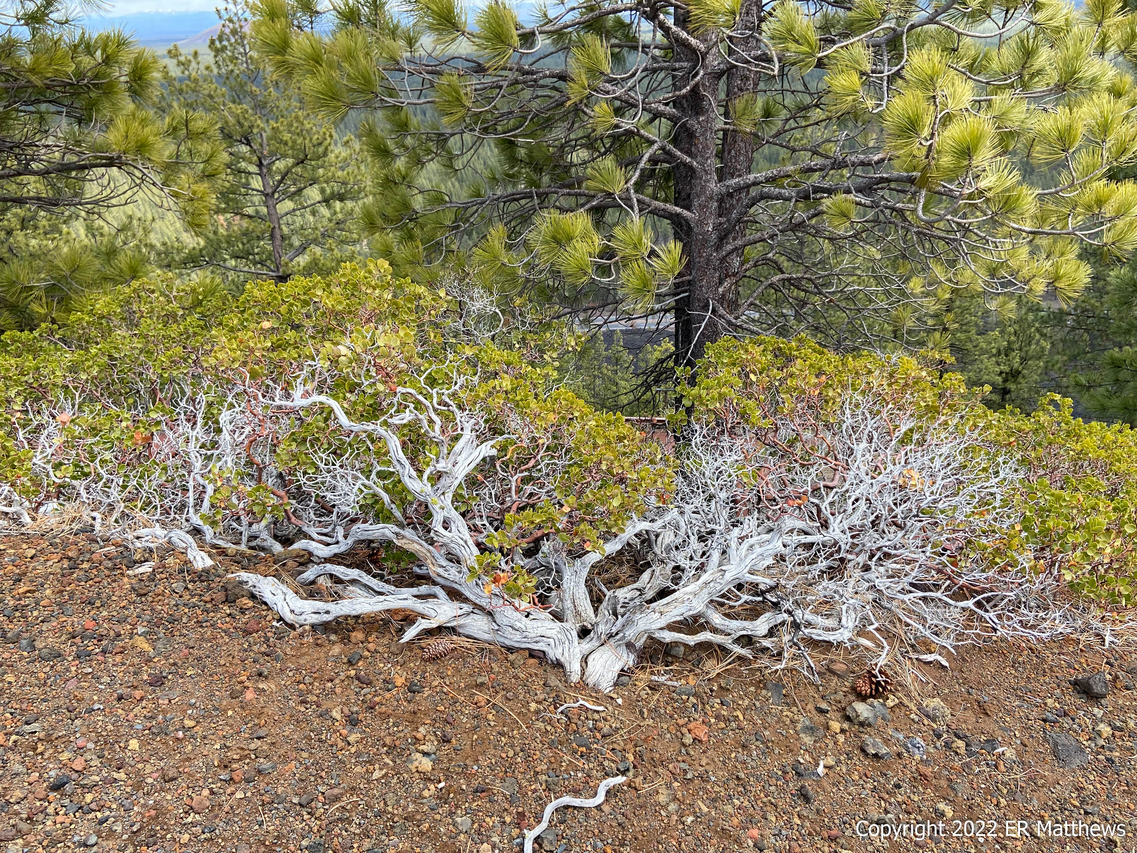
As you can see in the photos above, the flanks of the cinder cone are largely bare, with a scattering of Ponderosa Pines at the top. Extending out in all directions from the cinder cone are lava flows that are also largely bare, despite having been deposited on the plain some 7000 years ago. Around the edges where the lava starts to meet the desert, the flora starts to appear, mostly Ponderosa Pines, a few Western Junipers, Green-leaf Manzanita, Rabbit Brush, and Antelope Bitterbrush.
The walk up the red cinder road to the top afforded us great views of Central Oregon, though clouds did obscure the Cascades at times. The forecast was for intermittent snow flurries and although we got flurried on a bit on the way up, the day was largely sunny near the butte.
 |
| Snow Squall Approaching in the Distance |
With snow coming on from the west, we decided to head back down and to explore the trails in the lava field out behind the Visitors Center. On the way back around the rim trail headed for lower ground, I heard an explosive burst of happy birdsong, sounding almost like the House Finches nesting in the Blue Spruce behind our house.
Clearly not House Finches, these birds almost had me thinking that they were Purple Finches, a bird I used to see often as a child before they were chased off by the House Finches. On getting home and reviewing the photos, I could see that they are Cassin's Finches, a bird that I have never seen before, something of a rarity in that I have seen many hundreds of species in the US.
 |
| Cassin's Finch (Haemorhous cassinii) |
To make the day even more complete, as I was walking through the parking lot shaded by tall Ponderosa Pines, I saw a bird that I have been wanting to see for a very long time but have never lucked onto. As soon as it flew up, I recognized it immediately, reminding me of a slim Mockingbird and looking much like a large grey female Mountain Bluebird with a white eye ring, clearly a Townsend's Solitaire. It put on a show for me, hawking bugs from its perch.
 |
| Townsend's Solitaire (Myadestes townsendi) |
Back at the Visitors Center and still in the sunshine for the moment, we headed out back to explore the short (1 mile out and back) Trail of the Molten Land. Immediately into the lava field, we might as well have been on another planet, as otherworldly as it felt and looked, harsh, bleak, and truly unforgiving. It is no wonder that NASA brought astronauts here when I was a kid in the mid-1960s to train for lunar missions.
From up above on the caldera rim, the lava fields look flat. In reality, when walking through them, they are anything but flat, having large hills, lava tubes, and formations that resemble alien creatures.
 |
| Snow Squall Now Engulfing Lava Butte |
 |
| A Lava Tube |
I am largely at a loss when it comes to geology, yet I still find rock formations amazing. If you're not in a hurry reading this, take a moment to click through and enlarge the following two photos, which show a lava face with a squarish almost fish scale effect. It reminds me of looking at the top of a columnar basalt or columnar phonolyte formation, but those tend to be pentagonal and/or hexagonal in shape.
We humans do not have a good sense of geologic time as it works on a timeframe so far out of our reckoning. This lava field is about 7000 years old, ancient according to the scale of a human life, and yet geologically it is almost brand new. Bearing witness to this, the black plain is almost barren as far as the eye can see. And yet if you get up close with the lava, you can find small plants and trees starting to colonize the cracks, such as the dwarf Ponderosa Pine in the next photo.
 |
| Solitary Ponderosa in a Sea of Lava |
We quickly reached the farthest extent of the trail at the Phil Brogan Viewpoint under rapidly darkening skies. Looking to the west and getting a face full of wind-driven snow, we could see the snowstorm rapidly approaching, our signal to make back for the shelter of the Visitors Center and the truck.
 |
| Rapidly Approaching Snowstorm |
After a brief interlude in the Visitors Center where we looked a the three-dimensional map of the entire Volcanic Monument, extremely helpful in gaining perspective, we exited toward the truck under nearly black skies. As we pulled out of the parking lot, I could see a squall flying up the road towards us. We drove back to Bend through thick snow showers that dropped an inch in just a few minutes.


No comments:
Post a Comment