"A Lake Has No Name"
Without a doubt, No Name Lake in the Three Sisters Wilderness at the foot of Broken Top is one of the most visited destinations near Bend for those who are able to hike moderately difficult trails. At 8000 feet of elevation, it is the highest lake in this part of the world, fed by the remnants of an almost extinct glacier on the east face of Broken Top.
 |
No Name Lake and Crook Glacier Remnants
left to right: Ball Butte, Tumalo Mountain, Mount Bachelor, Broken Top
|
In surfing the recreation.gov app for a potential Central Cascades Entry Permit last weekend, I found an opening at Three Creek Lake, the Tam McArthur Rim Trailhead for Tuesday. The timing wasn't ideal as we had guests over on Monday night, but then, opportunities to score entry permits this time of year are scarce. I preferred an entry permit at a trailhead off of Cascade Lakes Highway because those trailheads are a shorter drive, but I got what I got, even if it meant driving to Sisters and then backtracking south about 15 miles.
In scoring the permit, I wasn't really thinking about hiking all the way to Broken Top, but I had contemplated visiting it several times over the past couple of years. In starting at the Tam McArthur trailhead, that would mean a round trip of over 12 miles with a couple of decent rock scrambles. Coming off a bad illness a couple weeks back (likely COVID), I knew I felt a bit weak and wasn't sure how much I wanted to bite off. Still, driving an hour to the trailhead and back, a total of two hours, just to hike five miles to and from the Tam McArthur Lookout seemed rather pointless.
Before I left home, I texted Ann (who was still asleep) that I would decide whether to press on to Broken Top when I got to the top of Tam McArthur. When I head out into the wilderness, I like to let someone know where I will be and when to start worrying if I do not return. I expected not to have signal out there to let her know my plans in real time, but there was marginal signal above 7500 feet in certain areas. I was able to let Ann know that I would press on to Broken Top. And I was able to send her a the photo above from 8350 feet on the rim above No Name Lake.
I was away from home just after 7:00 and starting up the trail at 8:05. The drive out of Bend was smooth despite all the road construction on the northside. Once I got into Sisters and turned south on the paved but bumpy NF-16, it was beautiful, if cloudy. Low clouds were scudding along and each time I would sight North Sister, the top was obscured with a cap of clouds. At the southern edge of the Ponderosa forest where because of the elevation, the trees were starting to change to firs, hemlocks, and Lodgepole pines, I spied a pair of large Mule Deer bucks with their big racks still in velvet. They will start scraping their antlers in just a couple weeks.
The final couple of miles into Three Creek Lake is a washboarded gravel road which my Tacoma does not mind in the least. I arrived at the trailhead sign to see perhaps five other cars pulled off the side of the road. I pulled in behind them, sucked down a pint of water, ate a banana, and hit the trail.
I would return to the truck mid-afternoon, my previously broken left foot aching from the long rock scrambles and my bum right knee screaming in its brace from the long and at times steep downhills. God, how I hate downhills.
I loved this hike and I am really surprised at the wildflowers still in bloom, a testament to the heavy snow cover this past winter. I rarely get the chance to see alpine flowers and so many of the ones that I photographed, while similar to species from lower elevations, are new to me. No Name Lake is as beautiful as I have heard and I look forward to going back, perhaps from a different trailhead next time. The photos below are in the order that I shot them.
If this post contains a lot of photos of the clouds, it is intentional. Rarely have I ever seen more interesting and photogenic clouds. In many cases, I want to call the cloud cover lenticular, but that may not be entirely appropriate. It seemed in many cases that each of the tall peaks above 9000 feet was topped with a cloud resembling a beret.
The trailhead sits at 6500 feet on the eastern side of Three Creek Lake, about 4 miles as the crow flies ENE of Broken Top. As the trail heads south along the lake, it climbs pretty quickly through a typical Lodgepole Pine and Whitebark Pine forest. I was greeted raucously by a bunch of Clark's Nutcrackers as I made my way up the hill towards my initial goal, the lookout on Tam McArthur Rim.
 |
Tam McArthur Rim Lookout in Center of Ridgeline
|
In several places in the initial climb, the trail goes across what seems to be vertically oriented slabs of shale. Sedimentary rock like shale is not really a thing in the volcanic realm of the Cascades. This shale mimic is a high silica content rock called andesite.
Above 5000 feet, our typical rabbitbrush is Bloomer's Rabbitbrush, a cousin of Rubber Rabbitbrush but not of Yellow Rabbitbrush, both of which are easily confused. Bloomer's, however, is a shorter (rarely more than knee-high) shrub with pretty yellow blooms that are more attractive than those of the other two.
At river level, both Rubber and Yellow Rabbitbrushes are just coming into full bloom, the Yellow Rabbitbrush being the earlier bloomer by about two weeks. I noticed on my drive south out of Sisters that the Bloomer's Rabbitbrush is nearly finished. The patch below is the exception at 7000 feet. I did not see any plants above 7000 feet, however, which seems typical. It seems to stop about the tree line, 7000 feet, on nearby Tumalo Mountain.
 |
| At 7000 Feet, Bloomer's Rabbitbrush, Ericameria bloomeri |
 |
| Neat Clouds on Top of North Sister |
 |
| Mount Washington Peaking out of Clouds |
Once the trail climbs to altitude from the lake onto the rim, it bends to the west and climbs along the rim to the viewpoint. If you look at a topographic map, you can see why it is called a rim. The so-called rim is a relatively flat space on top of a large steep escarpment to the north. It looks like a giant with an ice cream scoop dug out three huge scoops from the hillside. In reality, the giant was one or more glaciers that carved out the cirque that now contains Three Creek and Little Three Creek Lakes.
 |
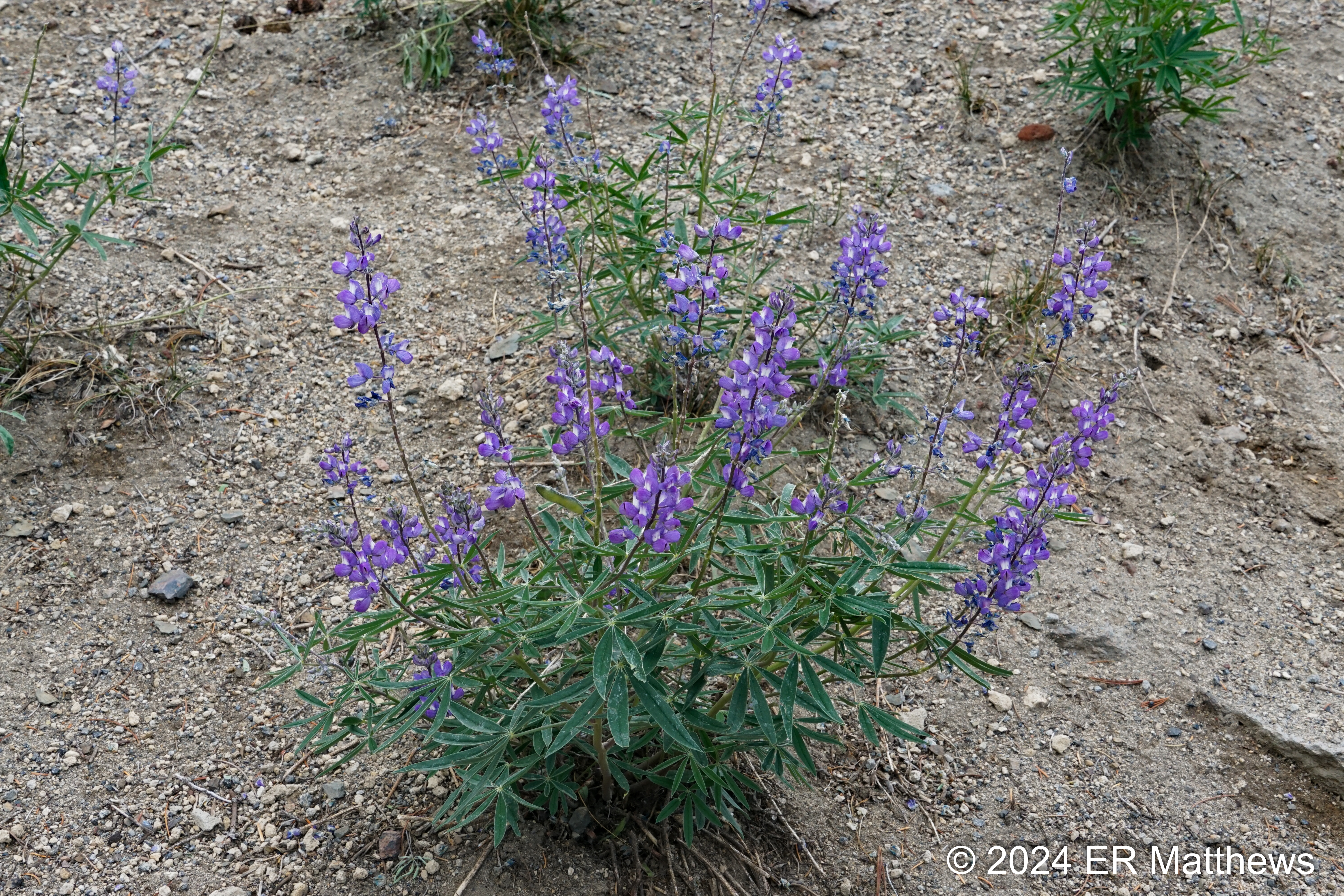
This is our Common Lupine, Though I Know not Which
In Bloom in Narrow Band at 7100 Feet |
 |
| Another Look at Cloud Cover on North Sister |
 |
| North Sister Peak Finally Visible |
 |
When a Lodgepole Pine and a Mountain Hemlock Occupy
The Same Spot: A Mix of Cones at the Base |
 |
| Heading to Viewpoint, First Look at Broken Top |
 |
| Broken Top with Broken Hand in Front |
Partway to the viewpoint, you leave the trees behind and walk through an off-white pumice plain decorated here and there with splashes of color principally from various buckwheats, the occasional Dwarf Lupine, and the bright red leaves of Newberry's Knotweed (
Koenigia davisiae) changing color and heralding the arrival of fall.
 |
| Sulfur-Flowered Buckwheat, Eriogonum umbellatum |
 |
| Alpine Wild Buckwheat, Eriogonum pyrolifolium |
Just before climbing to the viewpoint looking out over Three Creek Lake, at around 7500 feet of elevation, I started seeing lots of Cobwebby Paintbrushes, which do a remarkable job of blending into the bare ground around them. This is a plant that blooms typically in a light butter yellow, but ranges to a dusky orange/dull red. I found specimens of both, and an intermediate form with both colors.
 |
| Yellow Cobwebby Paintbrush, Castilleja arachnoidea |
 |
| Intermediate Coloration |
 |
| Dusky Orange or Dull Red Coloration |
 |
Approaching the Tam McArthur Lookout (elev. 7732 ft.)
Short Whitebark Pines (Pinus Albicaulis) on Top
Mount Washington on Horizon to Right |
 |
| Another View Showing Little Three Creek Lake and Three Creek Butte |
It seemed like it took no time to climb the 2.5 miles to the lookout where I was rewarded with excellent views to the west of Broken Top and Broken Hand. Moving to the north, Middle and North Sister seemed so close. To the north and below, both Three Creek and Little Three Creek Lakes glistened. Depending on cloud cover, I could at times see Mount Washington, Black Butte, and Three Creek Butte. On a clearer morning, I should have been able to see Three-Fingered Jack, Mount Jefferson, and Mount Hood. They were all visible when I walked back over the lookout in the afternoon.
As I moved along the steep rim of the south cirque wall, I got to see a massive rockslide on the former headwall of the glacier. The sun was starting to come up in the sky and light the Cascade peaks to the west as the morning clouds lifted. In a matter of 100-150 yards, I came upon the classic USFS CYA sign reading "Trail Not Maintained." This always seems to me to be where all the fun starts.
 |
| Massive Rockslide on Former Glacier Headwall |
 |
| I Sent This Photo to Ann: Clouds Over Broken Top |
 |
Headed for Broken Top
"Trail Not Maintained" Should Read "Fun Begins Here" |
Coming down slightly off the lookout, you enter a vast largely treeless pumice plain that runs along between 7700 and 7800 feet. This is the first opportunity to see to the south, the direction from which I originally wanted to approach but for which I could not get an entry pass. Although a lot of clouds to the north and west had already burned off, I really enjoyed the cloud cover on Mount Bachelor
 |
| Tumalo Mountain, Mount Bachelor, Ball Butte |
 |
| Ski Runs Visible Below Hat-Like Cloud on Mount Bachelor |
The walk had already been exposed for the past mile with the exception of a few patches of stubby pine trees here and there. Out on the wide open pumice plain, there would be no tree cover again all the way down to No Name Lake. Although the pumice plain looks barren to most people, it actually contains a nice selection of alpine flowers if you pay attention.
 |
In This Four-Square Foot Tableau: Cobwebby Paintbrush, Sulphur-Flowered Buckwheat,
Tundra Aster (Oreostemma alpigenum), Silver Raillardella (Raillardella argentea),
Pacific Lupine (Lupinus lepidus), Alpine Wild Buckwheat |
Heretofore, the temperature had been in the low 50s but the further west and higher I climbed, it seemed to dip into the mid-40s. As I crossed the pumice plain, the rock changed from light-colored pumice to rust-colored cinders. The higher I climbed, the more ferocious the wind became, screaming out of the NNW with nothing to break it. The last real cover I had against the wind was just before I came to a red cinder cone with a bank of snow still on its east side.
Although I was really happy to be in shorts for most of the walk, this ridge traverse was chilly. I was super happy when the trail dipped about ten feet below the crest of the ridge on the south (lee) side of the hill. I pulled up a seat on a lava bomb and had a good pull of water and a fig bar while the wind screamed over my head.
Midway across the red cinder ridge is a short rock scramble. The trail leads right to it and you take it on faith to climb up 10-15 feet. At the top where it seems there is no trail, the trail becomes quite visible on the other side as you realize how close to Broken Hand you really are.
 |
| Broken Hand Left, Broken Top (elev. 9177 ft.) Behind |
 |
| Classic Butte Formation of Broken Hand (elev. 8376 ft.) |
As I climbed to Broken Hand at about 8200 feet, I came to the vertical wall of the butte. The top seemed to loom over my head another 150 feet and the visible trail disappeared. The so-called trail passes to the north side of the butte just below the vertical section but it can be challenging to find. I found that I had climbed a few feet too high and faint trail passed just below me. Ultimately, after a quarter mile of slow rock scramble, you will pass the butte along the 8200 feet elevation line.
Just beyond here, the red rock disappears to be replaced with basalt or andesite of a gray color and a knob (about 8350 feet) covered in stunted Whitebark Pine krumholtz trees looms perhaps a quarter mile distant. The trail is nothing if not a rock scramble and you want to stay to the right side of the knob. After lots of fits and starts, you will ultimately crest the knob. On the other side, after climbing down a few feet, the trail becomes more distinct as it runs along the ridgeline. If you moved at all to the left side of the knob, you will have seen No Name Lake about 350 feet below. If you did not, you will soon see it as you traverse the exposed ridgeline.
 |
| No Name Lake (8000 feet) from Knob at 8350 Feet |
 |
| An Unknown Buckwheat on Rim Above No Name Lake |
The further you push west along the rim, the scarier it becomes if you have any fear at all of heights. Me, I am terrified of heights. I pushed my fear in making the final ridge traverse but it was certainly not beyond my abilities.
|
| Looking South, Totally Exposed with Sheer Drops to Either Side |
 |
| Looking North, Remnants of Bend Glacier |
After one good dicey section of sheer drops on either side, the trail starts to descend into the cirque that contains No Name Lake and the remnants of Crook Glacier. Sound rises well from the lake to the rim above. Not only could I hear hikers below me, but I heard the ice fracture a couple of times. It was nothing like hearing a glacier calve in Alaska, but it was neat nonetheless and totally unexpected. It took me a good ten minutes to descend to the water level on the trail that skirts to the east side of the lake, directly opposite the glacier, if we can still call it that.
Looking at both the profuse wildflowers and the small icebergs in the lake, I wandered along the eastern side all the way down to the moraine dam that keeps the lake pent up and where the trail heads south to the trailheads off of Cascade Lakes Byway. Subsequent to this hike, I found out that this dam collapsed, as moraine dams are wont to do, in 1966 and flooded all the way down the hill across the highway and into the Sparks Lake basin.
 |
| A Paintbrush Growing in the Middle of a Mat-Forming Penstemon |
 |
| Very Common in the Red Cinders, Dwarf Alpinegold, Hulsea nana |
 |
| A Mat of Penstemons, Likely P. davidsonii, Davidson's Penstemon |
 |
| Nearby, Littleflower Penstemon, P. procerus |
 |
| Elephant's Head Lousewort, Pedicularis groenlandica |
 |
| Lakeside: Elephant's Head Lousewort, Paintbrush, Hairy Arnica (A. mollis) |
 |
| Mat-Forming Tiling's Monkeyflower, Erythranthe tilingii |
 |
| Remnants of Crook Glacier |
 |
| Iceberg from Glacier |
 |
The Hill That I Descended and Then Ascended
350 Feet to the High Point at 8350 Feet |
 |
| Little Elephant's Head Lousewort, Pedicularis attollens |
From the bottom of the basin containing the lake, I retraced my steps back to my truck, just over six trail miles away, four miles as the crow flies. By the time I left the lake, 11:45 a.m., the sun was up strongly, the wind had died, and the skies were blue, a totally different day that when I started my hike. The return was much quicker with no real time out for photographs and way-finding. The return route through the rock scrambles was much easier to find having already come in the opposite direction.
 |
| One of Many Golden-Mantled Ground Squirrels |
 |
A Lava Bomb Looking Like Petrified Wood or a Kid's Play-Doh Project
Thick, Sticky Lava Cooled in Flight After Being Expelled from a Volcano |
The return trip was partly unpleasant in that my left foot ached where I broke it in 2023. I attributed the pain to all the off-camber maneuvers crossing the talus slope beneath Broken Hand. Likewise, for the first time in a long, long time, my right knee hurt terribly where I have dislocated my fibula many times. It really only hurt on the steeper downhills even with my brace on. Unfortunately, the way out is mainly a climb and the way back to my truck mainly a descent. I was extremely happy to get back to the truck and take the weight and brace off my knee. Despite the pain, it is a hike I would willingly do again.


No comments:
Post a Comment