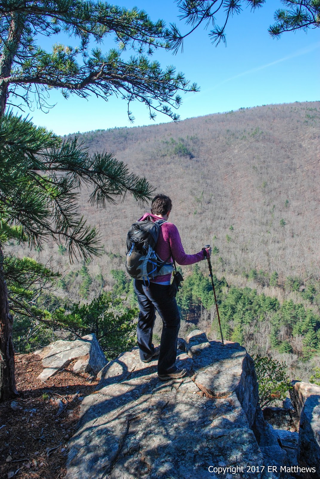
Warning: this is a really long post. I just don't come across days where the opportunity to photograph wildflowers is as good as it was this past weekend. You have been warned.
Ann is kind of banged up these days with a couple different injuries to her feet. This hiking thing is tough on us old folks. To let her feet rest a bit, for our tenth hike of our 52-Hike Challenge we needed a more or less flat hike and so I started thinking mid-last week where we could go that was both interesting and flat. When I think of flat, the C&O Canal always comes to mind. But the canal and solitude don't always go together. I've walked a lot of the canal from Harper's Ferry to Washington DC and in many spots, it is super-crowded on the weekends.
To avoid the crowds, I started by googling "most remote parts" of the canal and quickly found a bunch of references to the area around the
Paw Paw Tunnel. The tunnel was built over many years from 1836 to about 1850, nearly bankrupting the canal company, as a bypass for what are known as the Paw Paw bends in the Potomac. It was and remains a spectacular feat of engineering and is a great reminder of the early history of our country.
We made the quick drive from Winchester north up US 522 cutting northwest over through Bloomery to Paw Paw WV. Crossing the Potomac, which at this point runs almost due north, we found ourselves in Allegany County MD where we parked at the Paw Paw Tunnel campground. Although the postal address for this area is Oldtown MD some 12 miles distant, it is a stone's throw from Paw Paw WV.
Boy Scouts were packing up their camping gear as we arrived at 9:30 in the morning on what would prove to be one of the very nicest days imaginable with cool morning temps morphing into a 75-degree day under brilliant cloudless blue skies. There were already a lot of cars in the parking lot, but as I surmised, they were all there to visit the tunnel, turn around, and go on their way, whereas we planned to walk, hopefully in solitude, first over the tunnel on the hill trail and about five miles down the tow path before returning to the car via the tunnel.
 |
| Annie Signs "Hike Number 10" |
From the parking lot, we turned right (north) and walked along the canal, downstream, with the Potomac river about 100 yards on our right. It's about a half a mile to the tunnel entrance from the parking lot and we covered that quickly because when we started walking, it was about 50 degrees and we were wearing shorts for the first time this spring. It was really nice to don the trail runners and leave the Oboz boots at home along with the trekking poles. We found that the day quickly warmed up as the sun got above the hills.
 |
| Tiny Squirrel Drinking From the Canal |
 |
| Looking Through the Tunnel |
The tunnel is 6/10s of a mile long and you can see straight through to the other side. As we approached the entrance, it started to become apparent just how much stone had to be moved to punch this hole through the mountain. You can see in the photo below, using me for scale, just how big the cut is, despite the fact that the camera flattens out the perspective.
 |
| Photographing the Southern Entrance |
We opted to climb the Tunnel Hill Trail up and over Sorrel Ridge, saving the tunnel for the return trip. I'm glad we did. The morning light on the eastern side of the hill was spectacular for photography and in the afternoon when we returned, the cool tunnel was a welcome respite from the heat of the day. On the far side of the trail where it rejoined the tow path, the sign said that it was a strenuous climb up and over. We laughed at that, finding it a beautiful and easy walk.
Moreover, all the tourists stayed below and had a gander at the tunnel, leaving us to negotiate the trail by ourselves. We would see a handful of people when we returned to the tow path on the far side of the tunnel, but those folks were all destined to turn back around and return to their cars, leaving us with another three miles of quiet trail, punctuated every 45 minutes by a passing bicyclist.
 |
| Wild Pink, Silene caroliniana, Above Tunnel Entrance |
 |
| Tunnel Hill Trail Looking South, Upstream |
 |
| Neat Blazes, Most Have Been Disappeared |
As we climbed the trail to the ridgeline, we got some pretty nice views of the Potomac and West Virginia. The hillsides were blazing with both redbuds and cherries, while none of the deciduous trees had any leaves yet, giving us really great vistas.
 |
| Busted! |
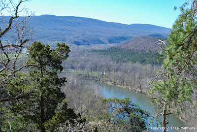 |
| North Upstream, WV on Right Bank |
 |
| Redbuds, Cercis canadensis, Were Phenomenal |
 |
| Ditto the Cherry Blossoms |
Starting up the hillside over the tunnel, the margins of the trails were littered with spectacular wildflowers taking advantage of the sunlight before the hardwoods leaf out in a couple of weeks.
 |
| Eastern Shooting Star, Dodecatheon meadia |
 |
| Dutchman's Breeches, Dicentra cucullaria |
 |
| One of the Railroad Trestles in the Bends |
I have heretofore only seen a few Birdfoot Violets here and there as individual specimens, but up on the Tunnel Hill Trail, once we had climbed sufficiently high, we found huge clusters of the strikingly beautiful plants. Here and there among the clusters were other violets such as Cream Violets, but no Canada Violets yet.
 |
| Birdfoot Violet, Viola pedata |
 |
| Cream Violet, Viola striata |
I still encounter plants from time to time that I don't know or that I've never taken the time to identify. Such is the case with the Cut-leaved Toothworts which were literally everywhere up in the woods along the hill trail, blooming in every shade from stark white to blushing pink.
 |
| Cut-leaved Toothwort, Cardamine concatenata |
We started seeing patches of Spring Beauty (Can you think of a more fitting name for this plant?) up on the hill and when we finally returned to the tow path below, there were stretches of the margins of the path that were carpeted in these gorgeous white to pink flowers.
 |
| Spring Beauty, Claytonia virginica |
Up on top of Sorrel Ridge, the trail quickly descended the north side of the hill and the wildflowers became noticeably fewer on the cold side of the hill. We descended from oak forest down much lower onto hillsides covered in pines. The rock changed from shale here to sandstone and we walked through huge patches of yellow-green lichen on our way down to the canal.
 |
| Descending to the Canal on the Hill Trail |
Coming off Sorrel Ridge, we emerged on the canal running right through the middle of a giant cut through the rock. We followed the tow path north downstream for another four miles past a series of defunct locks.
 |
| Water Spilling into Lock 66 |
 |
| Lock 64 2/3 |
 |
| One of Several Well Pumps in the Park |
 |
| White-breasted Nuthatch, Sitta carolinensis |
 |
| Posing on Lock Ruins |
Back down on the tow path, we started seeing some wildflowers in vast patches. Where we saw a few individual Early Saxifrage plants up on the Tunnel Trail, the rocks along the canal were covered with vast mats of these beautiful white flowers. Coming through the woods, we saw a few specimen Dutchmen's Breeches, whereas along the tow path there were stretches of 20 and 30 yards where the entire side of the path was covered in little white breeches.
 |
| Early Saxifrage, Micranthes virginiensis, on Lock Wall |
 |
| Crazy Daffodil (Narcissus spp.) Along a Creek |
 |
| Wild Blue Phlox, Phlox divaricata, Uncommon in This Location |
As we drove from Winchester to the park, we crossed the Cacapon River on a little backroad just outside of Bloomery WV. I pointed out patches of Virginia Bluebells blooming alongside the road to Ann. I was disappointed that for the first 2.5 miles of our hike, we saw no bluebells alongside the tow path, but then the further we walked downstream, the more we started seeing a few individual plants, followed by small patches, followed by vast patches, all in full bloom. They are one of my favorite harbingers of springs. What a bonus to catch a swallowtail feeding on one patch of them!
 |
| Virginia Bluebells, Mertensia virginica/Eastern Tiger Swallowtail, Papilio glaucus |
This time of year and even earlier, the roadsides are carpeted with the sunny blossoms of Winter Cress. It is so common that I rarely stop to photograph it, but this particular plant was calling to me. You can see exactly how much the bloom looks like other Brassicas such as broccoli and yu choy. In an amusing coincidence, we had some guests at the restaurant for a tasting on Saturday night and they showed me a picture of a road median carpeted in cress and asked if I could identify it. No problem.
 |
| Winter Cress, Barbarea verna |
 |
| Wood Vetch, Vicia sylvatica |
Sycamores,
Platanus occidentalis, are one of Ann's favorite trees, though she seems to have a mental block in recalling their name. Their white, peeling bark is quite a sight especially in winter when the trees have no leaves. They love wet feet and so if you are looking for water, find the nearest sycamore and you will no doubt find running water. I love the contrast of the white tree branches against the clear blue sky.
 |
| Contrast of Sycamore and Blue Sky |
The turtles amused us greatly. We didn't see many in the early morning, but as the sun got up, they started hauling themselves out onto logs en masse to sun themselves. Unlike along more frequently trafficked parts of the canal, here in the wilder parts, the turtles are very skittish. 75 yards in the distance, I would see 40 to 50 piled up on a log, but as we would get just a little closer, poof! They all dove for the water at once.
 |
| Thousands of Turtles in the Canal |
 |
| Yellow Violet, Viola pubescens |
Canal side, there were several areas covered in Virginia Bluebells with bright golden stands of Golden Ragwort coming up through them. It's hard to imagine a prettier contrast of blue and gold.
 |
| Golden Ragwort, Packera aurea |
 |
| Star Chickweed, Stellaria pubera |
You probably recognize, if you garden at all, this little groundcover/weed that wants to take over your flower beds at home. Although it is a pain in the rear in the garden, this Bird's-eye Speedwell sure has beautiful, if tiny, blue blossoms.
 |
| Bird's-eye Speedwell, Veronica persica |
Garlic Mustard is another common weed and one that is an invasive non-native. But it is ubiquitous and it is edible, if you ever find yourself looking for some garlicky greens. The four-petaled cruciate blossoms clearly mark it as a member of the Brassica family, along with desirable edibles such as arugula and broccoli. There is something about the radial symmetry of the leaves in this photo that is very attractive to me.
 |
| Garlic Mustard, Alliaria petiolata |
Frankly, I was expecting more bird life along the canal than we saw. We were serenaded by the usual cast of characters: chickadees, nuthatches, wrens, three species of woodpeckers, crows, and cardinals. We heard one Bald Eagle that turned out to be a Blue Jay doing a spot-on imitation. As usual along the tow path, we heard dozens of Indigo Buntings, but could never get one to come down out of the tree tops where we could see it. Warblers were scarce, not abundant like they will be in just a few weeks. I did hear several Northern Waterthrushes and with enough perserverance (and getting myself a long way behind Ann) I finally snapped a few frames of one, the best of which (crappy though it is) is below. I love this little bird that reminds me a bit of the Dippers out west with all their bobbing and weaving. The pinkish legs are unusual too.
 |
| Northern Waterthrush, Parkesia noveboracensis |
Years ago when I was a lot more serious about birding than I am now, I could have told you instantly that the ducks we saw briefly along the canal and drifting on the swift river current were Common Mergansers. The black and white bodies of the males are quite diagnostic, yet they were far enough away that I couldn't say what they were until I could see the pictures full frame in Photoshop. Aside from hearing a few Canada Geese, we saw no other waterfowl or waders, most disappointing.
 |
| Common Merganser, Mergus merganser |
We stopped for lunch at the five-mile mark, conveniently in the shade of a railroad trestle crossing both the Potomac and the canal. Sitting in the shade was a welcome respite from walking in the warm sun, which was now directly overhead and starting to beat down on us, easily the warmest day we have had since October. We're not quite ready for the heat yet.
I packed us small containers of farro salad, grilled pork tenderloin, and tzatziki. It always amazes me how stellar food tastes after you have been walking for several hours. It seems like whatever you are eating under those circumstances might possibly be the best thing you have ever eaten!
 |
| Our Lunch Spot in the Shade of the Trestle |
We were constantly remarking on what a difficult task it must have been to cut the canal through rock and we kept coming upon spots like that in the picture below that were phenomenally beautiful. The photo cannot do this hillside justice. Besides losing the perspective of how high the hill actually is, the photo does not record the amazing texture of the cedars growing on and along these canted layers of stone, nor of how incredibly difficult it must have been to blast and remove the stone where the canal now runs.
 |
| Cedars on the Rocks are Beautiful |
On our way back with the sun directly overhead, some of the flowers that were not fully open on the outward leg of our hike opened more fully, such as the Bloodroot and the Trout Lily below.
 |
| Bloodroot, Sanguinaria canadensis |
 |
| Trout Lily, Erythronium americanum |
Retracing our steps for about four miles, we came to where we joined the tow path from the Tunnel Hill Trail. Rather than climbing back up the hill, we kept going on the tow path in the direction of the mouth of the tunnel. At this point, we were in the heart of the gigantic cleft that had been blasted into the rock and water was spilling off the cliffsides into the canal all along.
The photo below shows a creek cascading over the side of the cut onto the tow path. The water trickling down the moss was just fanastic. I would have enjoyed it more if I had on some waterproof boots instead of my trail runners. It was impossible to traverse a section of the path here without stepping into some serious mud. Mud. That's something new on a hike. Not!
 |
| Creek Cascading over Rock and Moss |
 |
| Looking Back up the Cut |
 |
| One of Many Waterfalls |
It was getting hot in the blazing sun down in the breezeless rock canyon through which the canal passes despite the mist from several waterfalls. We reached the shade of the tunnel none too soon for a well-earned vacation from the sun.
 |
| Brick-Lined Tunnel |
Ann and I both donned our headlamps and headed into the darkness. Although you could make the trip without a light, you should not. The trail is rough in places and full of holes that collect water from the incessantly dripping walls of the tunnel. And there is a place where a small creek several inches deep runs along the path for a few feet. It is much darker than this highly overexposed picture would lead you to believe.
 |
| A Survey Marker Inside the Tunnel |
 |
| The End |