Crappy Picture Alert: We hiked in a downpour all morning so these photos were shot on my iPhone through a waterproof bag. I've done my best to clean them up. Some of them still suck.
 |
| Hike 14: DuPont State Forest |
"
We could stay at home, watch TV, and pout."—Annie
Monday in Asheville dawned leaving no doubt about the coming rain for the day. As Ann said, we could stay at the B&B and hunker down behind the TV or we could do what we set out to do and hike our fourteenth hike of 2017 at
DuPont State Recreational Forest, technically in Cedar Mountain, NC. The closest town of any size is Brevard. DuPont was transferred from the DuPont company to the state of North Carolina and is home to a great concentration of spectacular waterfalls in close proximity, waterfalls known from recent movies such as
Last of the Mohicans and
Hunger Games.
But first things first. Breakfast. Because of the short hike and short travel time, we had plenty of time for a leisurely breakfast in the dining room of the B&B and the breakfasts there are really not to be missed. After a starter of fresh pineapple, we were served a delicious smoked salmon and dill egg bake along with perfectly cooked asparagus and a blueberry-lemon muffin. Coffeehounds that we are, we loaded up pre-trip with several cups of very good coffee.
 |
| Smoked Salmon Egg Bake, Asparagus, and Blueberry Muffin |
Just as we were loading up the Jeep in the sprinkles for our hike, a Brown Thrasher zoomed up out of the yard and onto the branch of a Black Walnut tree not 30 feet away. I grabbed my camera, ripped the lens cap off, turned it on, and managed a single shot before it flew away. Lucky shot. I always try to leave the camera in a known configuration so that if I need a quick shot, I don't have to guess how it is set up, an old habit from my birdwatching days when I would leave my binoculars set at a known focal length. Brown Thrashers are supposed to be common birds, but I see them rarely. Every few years we will have a pair nest in the back yard, but certainly not often.
 |
| Brown Thrasher (Toxostoma rufum) in Black Walnut Tree |
It took us about an hour, perhaps a little more, to drive south from Asheville. In this part of North Carolina, there aren't any direct roads to anywhere and lots of curvy little backroads, beautiful, but not conducive to zipping between points. Although it was only sporadically sprinkling when we left Asheville, it was well and truly pouring by the time that we arrived at the parking lot for the Hooker Falls Access Area.
 |
| Well and Truly Pouring Almost All Day |
All the maps and guides we read about hiking DuPont make things seem very much more complicated than they actually are on the ground. In reality, we took a very simple straight-line out-and-back hike of 7.8 miles to visit four sets of falls on the Little River. The following directions should help you sort things out.
When you are approaching the park coming south on Staton Road from Crab Creek Road, you will descend a hill with a clearly visible bridge over the river. Start slowing and turn right into the Hooker Falls parking lot just before the bridge. Drive through the lower lot into the upper parking lot facing the footbridge over the river. You will start hiking by going to the river by the bridge and turning right (downstream) and following it a short distance to Hooker Falls. Continuing downstream just a few yards, you can walk down by the river and see the falls from below.
The directions we had were so convoluted that we ended up in a small cemetery a few hundred yards from where we should have been. Remember: go to the footbridge and follow the river to the right downstream.
 |
| Below Hooker Falls |
At Hooker Falls, we saw a lot of wildflowers along the banks of the Little River; following are photos of the best of them. Because of the downpours all day, I had my phone in an aLOKSAK electronics bag. While it is clear and waterproof to many meters of depth and protects the phone, photos taken through it, especially when rain is streaming down the bag, suffer greatly in quality. On the other hand, we do have some photos to document our trip where otherwise we would not have had any. I had zero problem operating the phone through the bag either. So it is kind of a win and I do keep one of these bags in my pack just for rainy days.
One thing I thought was really cool was seeing Spanish moss hanging from trees along the river. In the fog and mists, the wispy strands of moss gave our environs quite an eerie feeling. Unfortunately, in the rain, the effect didn't translate to photos. It just made the trees look foggy and out of focus. I mention the moss because I surely did not expect to see Spanish moss in this particular part of the world.
 |
| Lyre-leaved Sage, Salvia lyrata |
 |
| Black Locust, Robinia pseudoacacia |
 |
| Gorgeous Aronia melanocarpa Blooming |
 |
| Carolina Spicebush, Calycanthus floridus |
After you have seen Hooker Falls, do a 180 and backtrack to the footbridge and cross it, following the path under the road bridge upstream along the river to Triple Falls. You're definitely going to want to descend the wooden stairs to get down to the falls. You can get very close to the water here as you see I have done in the photo below. Here is where Ann slipped on a rock and really severely strained her PCL, something she would regret all week.
 |
| Triple Falls |
 |
| On the Rocks by Triple Falls |
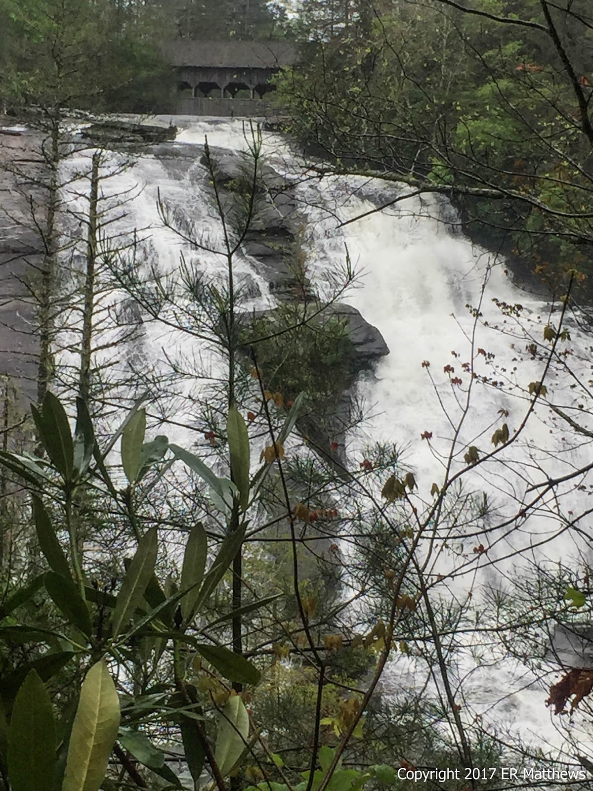
After viewing Triple Falls, continue upstream to High Falls. Before High Falls, the path forks. If you continue straight (the left part of the fork), you go to the base of High Falls which you certainly want to do. Then you can backtrack to the fork and head right up the hill to the overlook above High Falls, looking directly upstream.
 |
| High Falls from Below |
 |
| High Falls from Overlook |
As we were walking to the base of High Falls, I skirted a large puddle in the path bringing me very close to the bank overhanging the path. Suddenly, an Ovenbird (
Seiurus aurocapilla) rocketed explosively but silently past my knee and perched briefly in a small downed tree across the path some 15 yards ahead before disappearing into the woods. I surmised that the little brown-streaked warbler was nesting in a hole under the bank. On our return trip, I looked up under the bank and sure enough, there was a nest in a hole containing four brown-speckled eggs.
 |
| Ovenbird (Seiurus aurocapilla) Nest |
After viewing High Falls from the overlook where you can clearly see the covered bridge above the falls, you should continue up the hill and then turn left and left again to head to the covered bridge. The second left to the bridge is clearly labeled and will dump you out on the dirt road (Buck Forest Rd) just as it crosses through the covered bridge.
 |
| Covered Bridge Above High Falls |
We ate lunch up under the cover of the bridge, happy to take our hoods down after a morning in the rain. We were dressed in our rain jackets, shorts, and Keen water shoes. Given the mild temperatures and our being resigned to being wet, this was good enough clothing. Our shorts were soaked from all the water pouring off our jackets, but our cores stayed good and dry and we never were cold. Wet yes, cold no.
During our brief stop for lunch, I watched both Northern Rough-winged Swallows and Eastern Phoebes come and go, obviously nesting under bridge.
 |
| Interior Detail of the Bridge |
Just beyond the bridge there is a small swamp that was quite eerie when we walked by it. Though it looks very light in the photo, it was much darker and more mysterious in person.
 |
| Swamp Just Past Bridge |
Should you feel like walking up to Bridal Veil Falls, as we did, know that it is a road walk on dirt roads and just a little less than 3.5 miles round trip from the covered bridge. After walking from Hooker to High Falls, going to Bridal Veil will double the length of your hike. That said, the walk is flat and you can really make time on the roads. With vehicular traffic, dirt roads can be really dusty in dry weather. Ordinarily I avoid them like the plague, but in the pouring rain, it wasn't an issue for us.
Head to Bridal Veil Falls by continuing across the bridge on Buck Forest Road and take the next right on Conservation Road. The better part of a mile along, you'll cross a creek (actually the overflow from the Lake Julia dam) and then the earthen dam itself will loom above you on your left. It was just about the dam when it started thundering and the heavens opened up. The rain became a fairly brutal downpour for about 10 minutes.
Continue walking the road until you come to Bridal Veil Falls Road and turn right. There is a small spur road heading right that you might confuse with Bridal Veil Falls Road, but the one you want to take is a bit further on and is clearly signposted. You will see horse barns just up on the left after you turn. The road quickly dead ends in a loop. The short trail to the falls leaves from the back of the turn around loop.
Bridal Veil Falls is completely different from the other falls we saw. It is a big lacy sheet of whitewater spilling down over a mounded dome of rock, really cool to see even in the pouring rain. I feel like it was worth the extra 3.5 miles to see. Your mileage may vary.
 |
| Bridal Veil Falls |
When you are done, retrace your path to your vehicle. About halfway back to our car, the front blew through, the rain and thunder stopped, and the sun started to come out. I was worried about the sun coming fully out and turning the afternoon oppressively sweaty, but it never came to that. We re-shot the picture of Ann at the bridge (the first photo in this post) in the sun after she limped all the way back on her badly strained knee.
DuPont State Forest was a wonderful place to visit for a short hike that took in four waterfalls. I know of no other place where you can see so many great falls so close together. Definitely, definitely worth going out of your way to visit.
Take-Aways
1. Hiking in the rain is underrated. The woods close in around you and it is a totally different feeling, especially with your rain hood creating limited visibility. And there will likely be no other fools to bother you. If you go with the flow and it is warm enough, it can be relaxing. On the other hand, I once spent four straight days on the AT just north of Springer in December in the rain and I can safely say that it was a miserable and dangerous experience.
2 Pit zips in rain jackets are awesome. Wearing rain gear is always a balance between getting wet from the rain on the outside and getting wet on the inside from perspiration. Pit zips really help.
3. That first bit of warming sunshine after a rainstorm is so welcome. It turning into a miasmic swamp is so not welcome.
4. There is no waterfall not worth seeing.
5. Keen Newport sandals are really wonderful for non-technical hikes. Between Max Patch, walking around Asheville, and this hike, I put nearly 15 miles on them in two days, the first time I've ever really done more than use them in and around water. Extremely comfortable with the caveat that you can pick up a lot of grit inside them. Perfect for a non-demanding hike in the rain.
6. You've had a great day when a place is so beautiful that you really don't want to leave
Now on to post hike beers. When we got signal on our phones, we found
Brevard Brewing on the main drag in Brevard. It was the first brewery in Transylvania County and is widely praised for their beers. They are a lager specialist in a world of ale houses, but lager isn't necessarily my thing. I made the mistake of telling our bartender that I was a hop head and that apparently pissed him off, hops not being their thing.
He put a glass of drinkable enough IPA (no doubt their customers forced them into brewing an ale against their will) in front of me with a side of attitude. No taste, no banter, just a glass of IPA and a helping of eye roll. Ann got something brown and whispered in my ear, "The bartender's a dick and I don't want to give him any more of our money," so we finished our beer and moved along to
Ecusta Brewing just down the road. To be clear, we went to their production facility called the Pisgah Forest location rather than their tasting room on Main St.
 |
| Good IPA, Bad Attitude |
Ecusta is the new kid in town but they're doing great beer. We had a great bartender and we joined a great crowd at the bar so we actually stayed a bit too long. Between us we tasted or drank six or seven of their beers and they were all very good quality. I'd surely go back.
 |
| Good Times at Ecusta Brewing |
 |
| F.U.P.A: "Messed Up" Pale Ale |
 |
| Some of the Fairly Rowdy Bar Crew |
We just weren't ready to leave but after sobering up a bit, we had to hit the road to get back to Asheville. Our plan was to wander into downtown Asheville to have some Champagne at the Battery Park Book Exchange and Champagne Bar and then venture down to Wicked Weed for some dinner and beer, but we had had our fill of beer already that afternoon and were too hungry and tired for that, it being already 9pm. And Ann's bum knee was bothering her, so, we dipped into a little restaurant,
Salsa, for a quick dinner.
 |
| Who is Very Happy? |
 |
| Green Man: Trying Another Asheville Beer |
 |
| Crab Spliff Roll, Pretty Good Drinking Food |
We started with a crab spliff roll, basically a crab chimichanga sliced three times on the bias and garnished with a red-brown mole and pineapple salsa. And then we had two different pork dishes, one a kind of take on carnitas. The food was decent enough especially after the food debacle the night before. It was getting late and we had a date the next morning with first Linville Falls and then Grandfather Mountain on our way to Boone where we would spend the next two nights, so we got going and walked the mile back to the B&B.