"Argghhh!" I screamed at 6:30 Sunday morning, having been full-bodied slammed into wakefulness by a monster charley horse in my right hamstring. Instantly my mind flooded with memories of how hot the restaurant kitchen was the night before, how much I was sweating, and how brutally long dinner service went on. The restaurant is now packed every night since I have announced that I am closing it on August the 5th and moving to Oregon.
 |
| The Falls |
Ann had wanted to go back to
Big Meadows and hike the three waterfalls there and when we were jolted awake at 6:30, I groggily reminded her that we should get going, given that it is a 2-hour drive from the house. Neither of us was feeling that drive, though Ann was the first to voice that. I had fallen asleep sometime after midnight and was up from 4:30 to 5:30 before falling asleep once again. Not enough sleep on top of a brutal week at the restaurant. So we lay in bed until the dogs forced us to get up and take them out at 7:00.
During coffee, Ann went in search of another, closer hike involving a waterfall and she found the
Falls Ridge hike on HikingUpward, the sister hike to our recent
Laurel Run hike. I didn't really care where we went so I gave a quick OK without checking out the hike and the corresponding elevation profile, which had I done might have set off some alarm bells. I don't care so much about grueling climbs (Annie calls me Mountain Goat) but long climbs are tougher on her than they are on me.
Hastily, I made some sandwiches for lunch and we got our daypacks packed and hydration bladders filled. In my groggy state, I was really lucky that I didn't forget anything. We got away from the house around 8am and headed south on I-81 towards Woodstock.
My earlier cramping told me that I was no doubt dehydrated and my electrolytes were out of kilter. I took two antacid tablets to get some calcium in my system and we made it a point to stop in Stephens City (Sheetz right at the exit ramp; easy on, easy off) to get some Gatorade and a breakfast biscuit. I hate Gatorade but it has its place. Still, it took me all day to drink the bottle and I had to wash it down with water each time I took a drink.
From Woodstock, we headed out towards Wolf Gap but took the turn to Liberty Furnace before heading up into the mountains, ultimately arriving at FR 252. I read on HikingUpward that the gate on FR 252 would be closed and that we should go in a back way, but not being familiar with the back entrance and being super-tired, I decided to just head up to the gate and take my chances. It was closed and so we road-walked the two miles to the beginning of the official hike, hike number 27 for us this year, and the two miles back after for a total of 10.9 miles for the day. The road walk wasn't terrible as there was no traffic to spew dust everywhere and we were really familiar with it from our recent Laurel Run hike.
 |
| FR 252 Closed |
On the map fragment below, you can see the gate across Laurel Run Road where we parked. We then hiked in to the official start of the hike, right at the You Are Here arrow below, where the purple-blazed Stack Rock Trail meets the blue-blazed dirt road. We continued down the blue-blazed dirt road past the gate on the far side (just off the bottom of the map) and then turned right up the mountain on the yellow-blazed Falls Ridge Trail. After taking a detour to see the waterfall and eat lunch, we climbed to the top of the mountain where we joined the orange-blazed North Mountain Trail for a few yards before descending on the purple-blazed trail and back to the car via the dirt road.
 |
| Our Loop Hike |
 |
| Walking In, North Mountain in Background |
One great thing about the roadwalk (six of our eleven miles were roadwalk) was the sheer number and variety of wildflowers in the sunny spots along the road. In places, the roadsides were covered in Queen Anne's Lace, sunflowers, or Heal-all.
 |
| Brown-Eyed Susan, Rudbeckia hirta |
 |
| Common Heal-all, Prunella vulgaris |
 |
| Butter-Plate Sized Queen Anne's Lace, Daucus carota |
 |
| White Campion, Silene latifolia |
 |
| Woodland Sunflowers, Helianthus divaricatus |
At one point, I found myself standing in an area of chicory that spanned the entire color spectrum from white to deepest periwinkle blue, just a spectacular show of color from one of our most common roadside weeds.
 |
| Common Chicory, Cichorium intybus |
 |
| Bumblebee on Thistle |
 |
Pale-Spike Lobelia, Lobelia spicata, Everywhere
|
 |
| Bee on Wild Bergamot, Monarda fistulosa |
 |
| White Snakeroot, Ageratina altissima |
 |
| Wasp on a Goldenrod, Solidago sp. |
 |
| Rattlesnake Weed, Hieracium venosum |
 |
| Tree Canopy Forming a Tunnel |
 |
| Still Life with Red Leaf and Coltsfoot, Tussilago farfara |
 |
| Tulip Poplar, Liriodendron tulipifera, Leaf Holding Rainwater |
 |
| Rainwater on Milkweed, Asclepias sp. |
 |
| New Redbud, Cercis canadensis, Foliage |
 |
| Who Lost This? |
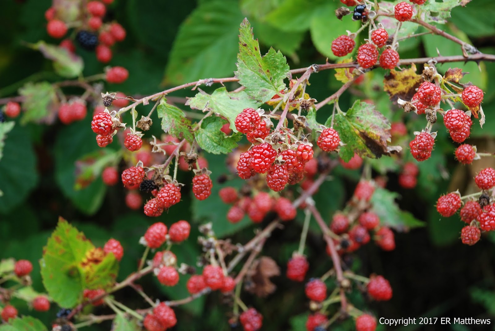
Another benefit of the extended roadwalk was the easy access to all manner of berries. We feasted until we could feast no more on wineberries, blackberries, and blueberries. At one point, we scared a bear that was down by the roadside eating berries. We never saw it, but we heard it crashing off through the bushes. The only large animal we actually saw was a lone doe who nervously watched us a bit before loping off a few feet.
 |
| Wineberry, Rubus phoenicolasius |
 |
| Pounds and Pounds of Unripe Blackberries, Rubus sp. |
 |
| Annie Feasting on Blackberries |
 |
| Unripe Blue- or Huckleberries, Vaccinium sp. |
After four miles of road-walk, we passed the second gate on FR 252 and turned right up the hill on the yellow-blazed Falls Ridge Trail. It immediately turned steep and almost all the wildflowers disappeared, except for a few white asters and a tickseed Coreopsis here and there.
 |
| Whorled Coreopsis, Coreopsis verticillata |
 |
| Tiny Red Oak, Quercus rubra, with Lots of Galls |
The directions on HikingUpward led us to believe that it might be hard to spot the side trail to the waterfall. Not so. There is a very large cairn marked with a white blaze opposite the trail. And the trail is newly marked with bright white blazes. The trail is steep and slippery in places although not long, but on the return trip to the yellow-blazed trail, you have a decent climb on your hands. And then you have an even longer climb to reach the top of the mountain on the yellow-blazed trail. All in all, it is up, up, up for a very long way. It is workout and we were feeling it especially in the suffocating humidity. I was sweating so much that the sweat was dripping off the brim of my baseball cap.
 |
| Cairn Marking Waterfall Trail |
 |
| Brand New White Blazes |
 |
| Annie Traversing Boulder Pit to Falls |
 |
| Falls are Not Very High |
 |
| Goofing |
 |
| A Blessed Relief from the Heat |
 |
| Indian Pipe, Monotropa uniflora, Near Falls |
 |
| A Salsify, Tragopogon sp., Seed Head |
All in all, our hike amounted to 10.9 miles, 6 of which were road walk and 4 of which were beastly up hill. Although a welcome respite from the heat, the small waterfall was probably not sufficient payoff for all the work, especially now that in the summer, there are no views from the top of the Stack Rock Trail as there are in the winter.
We were hot and tired when we arrived home to stand under the shower. Sleep came very easily Sunday night.


No comments:
Post a Comment