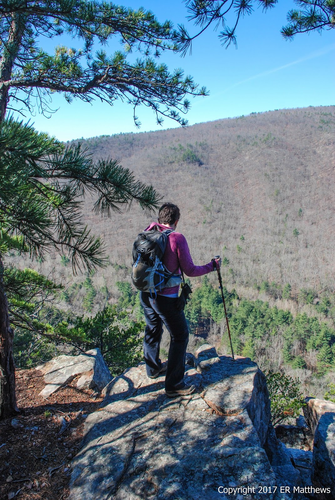
Sunday the second of April found us attempting our ninth hike of our 2017 52-Hike Challenge. Ann picked a hike a little south and west of Harrisonburg in Rockingham County in the George Washington National Forest, centered on the Hone Quarry Recreational Area, in a part of the Shenandoah Valley that I have never visited.
 |
| Hone Quarry: A Beautiful Recreation Area in GWNF |
I thought we'd try something different for pre-hike breakfast so I picked up a package of
riguas de elote at FoodMaxx on Saturday. Riguas are pancakes made from grated fresh sweet corn. They are big and one is plenty for a serving, so I heated two in the microwave for our breakfast and packed the other three to go. They're a bit sweet and taste very much of corn. That said, I need something else to go with them to help cut the sweetness. Ann was not pleased with hers and refused to eat another for lunch. Me, I was hungry, so I scarfed another on the trail. She's still a bit picky to be true hiker trash.
 |
| Our First Riguas Experience |
Riguas consumed, the Jeep packed, and flasks of coffee in hand, we drove south on I-81 until we got to the south side of Harrisonburg, about an hour from Winchester. From there, it was a bit of a contorted path to get to Hone Quarry on the far side of Ottobine. It took us a bit longer than we were expecting based on the map because as soon as we got to Dayton, southwest of Harrisonburg, we hit rush hour for the Old Order Mennonites going to church in their buggies. We encountered 25-30 buggies between Dayton and Ottobine.
 |
| Rush Hour Going to Church |
As we turned off 257 onto the somewhat paved Hone Quarry Road, we quickly became aware of a beautiful creek on our left, Hone Run. We saw a beautiful female Belted Kingfisher along the creek before we got to the parking area at the Hone Quarry picnic area, about 1.7 miles up the road. It was still a bit chilly in the morning so we got going quickly from the parking lot up the Cliff Trail (not signposted but the only trail leaving the northeastern side of the road just before the parking area).
There are two overlooks in quick succession for really the only views along the trail, except for a few views of the reservoir further on in some of the rockslide areas. We favor trails where the payoff is from the mid-point to the end of the trail, rather than at the beginning.
 |
| First Cliff Overlook |
 |
| Looking West from Overlook |
 |
| The Hone Quarry Dam is the GrassyArea in Center of Photo |
We climbed over more huge trees fallen across this trail that we have climbed over in the last six months.
 |
| Lots of Downed Trees |
 |
| Southwest from Second Overlook |
 |
| Admiring a Stand of Blooming Pieris |
 |
| Further North on Cliff Trail, Hone Quarry Reservoir |
There were long, long stretches of rocks on the Cliff Trail. I don't mind rocks but the seemingly endless scrambles through rockslides was a pain in the rear.
 |
| Long, Long Rock Traverses |
The Cliff Trail tees into the Meadow Knob Trail at the ridgeline north of the reservoir. Mercifully, the rocks end here and the path to the left is smooth up one knob and down into a saddle before climbing very steeply up Pond Knob. I have been ill for the last month, so I have very few legs under me at this point. We stopped five times going up Pond Knob to catch our breath. There were places going up this trail where we had to be careful to take small steps and to keep our weight over our legs. Otherwise, we would lose traction and our back legs would slide out from under us. That's steep.
From the top of Pond Knob, we descended steeply west to the valley floor where we picked up Hone Quarry Road, dirt at this point rather than shoddy pavement, about a mile and a half above the reservoir. As we walked the road back to the reservoir, we saw dozens of little streams trickling down the hillsides to join the roaring Hone Run in the valley floor. In places, Hone Run had three separate channels, all screaming with white water from recent rains. The rains caused the road to be very muddy in places as well.
In fact, in one spot, the road was covered by a mud puddle the size of a small pond and we had to skirt around it. My boot slid out from under me on the 45-degree mud incline and down I went, right on my ass in the mud. I was a filthy mess and I am quite sure that it would be funny as hell if we had it on video. Fortunately, nothing was hurt and there was lots of flowing fresh water to clean off in. The day was nice and warm and so everything air-dried quickly.
 |
| Lots of Streams Flowing into Hone Run |
The road walk wasn't a lot of fun, but at least we had it to ourselves until we got to the reservoir, half way back to the car. At the reservoir, we encountered lots of cars, dogs, and people, many of them fishing in the little pond, some canoeing.
 |
| Hone Quarry Reservoir |
I climbed up on the dam to take a photo of the reservoir while Ann continued down the gravel road. At one point, I found myself about 150 yards away from her as she trudged through a cut in the hillside that exposed layers of iron-bearing rock. I was definitely having a better time walking through the grass than along the road, where cars were throwing up dust.
 |
| Annie Trudges Through a Cut |
On the downstream side of the dam, the road comes very close to Hone Run, which is one of the prettiest trout streams I have seen in a long time. We walked for another mile on the road along the creek back to the car.
 |
| Hone Run is a Beautiful Trout Stream |
 |
| Fly Rod Anyone? |
 |
| Rapid Detail in Hone Run |
We saw a lot of birds on the day, starting with the aforementioned kingfisher. At one point, a couple of very pale cinnamon-tailed red-tailed hawks came flying over and of course, we were constantly entertained by the vocal croakings of the resident ravens. There were lots of little birds flitting back and forth down low, kinglets, chickadees, titmice, juncos and the like while up in the trees, white-breasted nuthatches were doing little mating dances. For a half a mile or more, we were treated to the drumming of a flicker on a dead snag. Coming down the backside of Pond Knob, I saw a lot of little warblers but the sun was so bright that I really couldn't see them in contrast. At one point, I pointed my camera at one and snapped a few frames, hoping I could adjust the contrast enough in Lightroom to see what it was. My brain was saying that the junco-like call was probably a pine warbler, but it wasn't until the next day that I could see in the photo that I was right.
 |
| Pine Warbler, Setophaga pinus |
 |
| Rock with a Moss Cap |
Spring was a lot more noticeable south of Harrisonburg than it is an hour north down the valley in Winchester. Notably, the willows and alders along the reservoir are starting to leaf out and there were many wildflowers in bloom, where we have almost nothing in bloom yet. The area around the campground in particular was littered with large stands of hepatica, bloodroot, and coltsfoot, all among the very first flowers of the year. I would mention the ubiquitous dandelions, but they are everywhere all the time.
 |
| Birdfoot Violet, Viola pedata |
 |
| Mountain Andromeda, Pieris floribunda |
 |
| Dwarf Cinquefoil, Potentilla canadensis |
 |
| Common Bluets, Houstonia caerulea |
 |
| Pink Cherry in Full Bloom |
 |
| Bloodroot, Sanguinaria canadensis |
 |
| Coltsfoot, Tussilago farfara |
 |
| Hepatica on the Rocks, Hepatica americana |
 |
| Trailing Arbutus, Epigaea repens |
Secretly, I think Ann chose this hike for its proximity to
Three Notch'd Brewing in Harrisonburg and not for any particular hiking merits. Consider the (de)merits of the hike: no payoff view, very rocky, long, dusty roadwalk. Tell me beer was not involved in this decision. After the hike, we headed north along the mountains to pick up US 33 back into town. US 33 becomes Market Street in Harrisonburg and happens to be the street on which Three Notch'd is located. All the vertical signs along the block next to the courthouse seem to be a direct throwback to when I was a kid in the 1960s.
 |
| Market Street: Back in Time |
 |
| Minute Man IPA |
Like so many smaller breweries, Three Notch'd offers no food, so Ann asked me to make some salsa to bring along with chips so that we could have some post-hike munchies with our beer. I charred tomatoes, onion, garlic, and jalapeño, and blitzed that lightly. Then I added salt, cilantro, and lime juice to taste. It's pretty rare for me to make a cooked salsa like this, but what else to do in the winter when tomatoes suck?
 |
| Ed-made Charred Tomato Salsa |
We got to talking with a young woman at Three Notch'd about places to grab a quick burger before hitting the road back to Winchester. By this time, it was 4pm and we were about famished. She mentioned
Jack Brown's right around the corner and was extolling the virtues of their burgers and how it ended up #11 in the country on somebody's list of burger joints. [I am always skeptical of such lists: a case in point,
Melt in Leesburg, VA.]
Sounded fantastic, right? We popped around the corner, went in, and were lucky enough to get a seat at the bar. The place is tiny and seats perhaps 8 at the bar with one small table in the front. Right off, I couldn't help but notice the chandelier draped with bras hanging above a disco ball, the cow skull on the wall, or the bike suspended from the ceiling. Definitely kitschy!
 |
| Eclectic Jack Brown's |
 |
| Burger and Fries |
And the verdict? Despite the claim to use Wagyu beef and this and that, it was just another cheeseburger of about average quality. Cool place to dine, but we can get better burgers in our area. The fries, really, frozen crinkle cuts? Sorry guys. It was good and it hit the spot for some famished hikers, but it wasn't all that and a bag of chips too.